HOME RANKINGS CHALLENGES ROUTES POI PLANNING SEARCH LOGIN
Italy - Emilia-Romagna, BO
2023/12/31 16:16:55

Alto Crinale

4 Downloads
0
 
Share
Author
CornoBike
(3)
Place
Italy - Emilia-Romagna, BO
Km
40,15 km
Elapsed time
05:40:23
Vertical meters
+1 370 mt (732 - 1790)
Route difficulty
Landscapes
Last update
2023/12/31 16:25:02
Comments
0
Description

This is one of the most characteristic routes in our area with most of the trail being outside the tree line.

The departure is from Rifugio Cavone, a short asphalt stretch and after the tunnel that passes above the Tomba slope we find on the left the forestry trail (CAI 329) that, passing by Rifugio Le Malghe(1640 meters), takes us takes us to the junction for CAI 401 trail up to Passo della Riva (1454 meters), here we take the CAI 445 trail on the left that after a fun single track becomes a forest road up to Capanno Tassoni (1370 meters), from here we climb along the forest road up to Passo della Croce Arcana (elevation 1669). Continue climbing until you take the path on the left that goes up to the summit where there are many antennas and repeaters and then take the single track on the ridge (CAI 00) that will take us up to Lago Scaffaiolo (1787 meters).
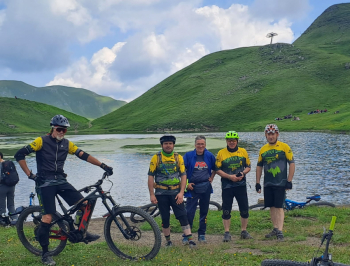

To return to the starting point, you can descend along trail 333 (gps track) or along the forest road that serves the Lake Scaffaiolo refuge.


Download our free mobile app to send this route to your Garmin device or to navigate it on OSM maps. Android - iOS
Local weather
°C
°C
°C
°C
°C
°C
°C
°C
°C
°C

Graph

Nearest Routes

2024/06/09
- Italy - Emilia-Romagna, BO
Paoloc1
(60)
30,53 km
Km
+1 700 mt
Vertical meters
Route difficulty
Landscapes
2024/01/28
- Italy - Emilia-Romagna, BO
CornoBike
(3)
32,32 km
Km
+1 340 mt
Vertical meters
Route difficulty
Landscapes
2023/09/25
- Italy - Emilia-Romagna, BO
Paoloc1
(60)
40,20 km
Km
+2 100 mt
Vertical meters
Route difficulty
Landscapes
2023/12/30
- Italy - Emilia-Romagna, BO
CornoBike
(3)
31,29 km
Km
+1 410 mt
Vertical meters
Route difficulty
Landscapes
2023/07/06
- Italy - Emilia-Romagna, BO
ebsat
(107)
27,77 km
Km
+1 460 mt
Vertical meters
Route difficulty
Landscapes
2023/06/21
- Italy - Emilia-Romagna, BO
ebsat
(107)
39,10 km
Km
+1 900 mt
Vertical meters
Route difficulty
Landscapes
2023/01/17
- Italy - Emilia-Romagna, BO
ebsat
(107)
27,55 km
Km
+2 207 mt
Vertical meters
Route difficulty
Landscapes
2024/06/14
- Italy - Emilia-Romagna, BO
ebsat
(107)
25,40 km
Km
+1 656 mt
Vertical meters
Route difficulty
Landscapes
2023/07/10
- Italy - Emilia-Romagna, BO
ebsat
(107)
36,13 km
Km
+1 570 mt
Vertical meters
Route difficulty
Landscapes
2023/01/06
- Italy - Toscana, PT
ebsat
(107)
28,08 km
Km
+1 564 mt
Vertical meters
Route difficulty
Landscapes

0 Comments