Italiano
 Deutsch
Moncuni da Rivoli

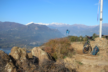
Parked a little outside the Castello area, but there are plenty of parking spaces on Viale Papa Giovanni XXIII°. After the tree-lined avenue on asphalt, continue on Strada Fontana Costero and turn right onto the main dirt road, the Pilgrims' Path. In November you may find logging work to be overcome with some difficulty. A variant path to the right takes us to Roc Pera Grossa, where one of the largest erratic boulders of the morainic amphitheater between Rivoli and Avigliana is located. We then reach Roca Sgaroira 505 meters and turn on a small path to the left to get to the asphalt variant at Reano that allows fabulous views from Monviso to the south to Rocciamelone to the west. The next dirt road has a few challenging climbs in the vicinity of Col Buchet. The climb ends at the metal cross overlooking Moncuni (Monte Cuneo) at 641 meters above sea level. In the Giaveno basin the mountains of Val Sangone emerge, including Rocciavrè and Robinet. To the south is Mount Pietraborga, to the west the Sacra di San Michele, Rocciamelone to the Musinè. The 130-million-year-old Moncuni rocks are outposts of alpine ranges, and moraines have rested on top.
The first downhill section is a nice single track with sections of roots and fixed stones and reaches Moncuni Fountain, which was once the main water source in Case Canale. We cross Reano, a short stretch skirting the fields takes us to the municipal road from Reano to Rivoli, then via dei pellegrini in common with the outward journey, at Pera Grossa turn right onto wide dirt road and finally Pozzetto road to Rivoli.
Cartography: Fraternali 1:25,000 no. 4 Bassa valle Susa, Musinè, Val Sangone, Collina di Rivoli
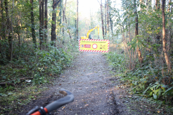
Fall work on the pilgrims' path, in the section between Rivoli and Reano
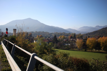
Pera Grossa locality
Reano, view of Monte Pietraborga and in the center at the bottom Monviso
Moncuni, Avigliana lakes, Sacra di San Michele, snow-covered Rocciamelone