Italiano
 Deutsch
Tignale Super Enduro

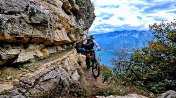
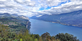
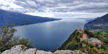
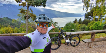
Back to Lake #garda and Tignale, the home of Lake Garda flow with three climbs and three descents a bit for everyone that will keep you entertained. The gem? I would say trail #266 on Mt. Cas but especially the Piemp Valley.
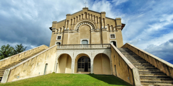
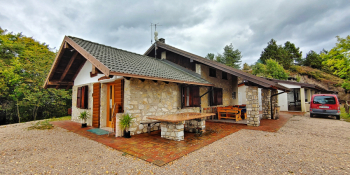
New thrills, new uphill variations to make this classic tour more and more exciting. We start from the parking lot below Monte Cas and head towards the center of Tignale. Past the SunClass the climb becomes more steady. At about 980 meters we pay attention because we will deviate onto a hidden trail that will take us into the Piemp Valley. Out of the world we will reach the dirt road that leads toward the Ere Pass. Here we take with one last tear the now famous Tignale Extended Flow Emotion: about 4.2 km of super Flow descent where we let the baby flow before returning to that of Tignale. Now we go up again but this time we will do the direttissima. Passing Casa Piemp at 860 meters we deviate onto the dirt road to the right and with good gradient we take the firebreak that will take us to the Piemp hut. From here we go back down: first section backwards then at the next bar we deviate to the left. Begins the Trail dei Tornanti all in very nice undergrowth with roots, few rocks and a lot of fun where you can learn the technique on the narrow. Arrived at the parking lot of departure we face the ascent of the Via Crucis then Monte Cas admiring the sanctuary of Monte Castello. Watch out for No. 266 overhanging the lake before descending on trail back to Tignale then to the starting point.
RECOMMENDED ROUTE FOR MOUNTAIN BIKE and/or E-BIKE ALL MOUNTAIN.
NB: At the time of entry this ride is all doable without any particular problems. We disclaim any responsibility for any inconvenience due to lack of maintenance of the trails or deterioration of the same due to external agents and / or natural and a wrong assessment where the tour.