
 Italiano
 Deutsch
Vira - Monte Tamaro e discesa sul Carbon Trail

Ascent from Lake Maggiore to just below the Tamaro, with some steep and very strenuous sections. The first is shortly after the start: the so-called Strada Romana, which leads from Quartino to the Monte Ceneri pass, is about 300 meters in elevation gain, and you'll be glad once it's over with its cobblestones, which are slippery even uphill when wet. From Ceneri you start the classic ascent of Monte Tamaro, now partly paved (tip: take the cable car as described here). 1100 meters of fairly humane elevation gain to get above Alpe Foppa, where the last 300 meters of elevation gain begin that will make you suffer but finally bring you to the end of the climb at the Monte Tamaro Hut.
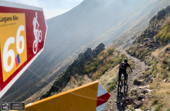
The partly exposed traverse begins that takes you all the way below the summit pyramid of Monte Tamaro. You take a left following the 66 Lugano Bike route to Bassa di Indemini. Here we change sides and follow a not very well-maintained trail (very narrow and lots of stones in between) that will take us into the Indemini valley.
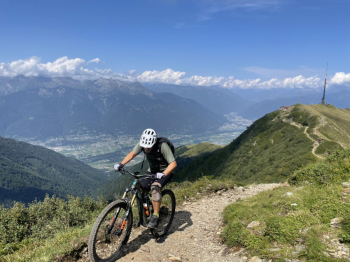
We then come out on the paved road that leads to Alpe di Neggia. We follow it uphill for a few hairpin bends and, once we get to the pass, we take the Carbon Trail: 1100 meters of very varied downhill elevation gain that will take us back to Vira. You can read the description here. Beware that when the leaf falls, this trail literally disappears.


