
 Italiano
 Deutsch
2023/09/30 17:45:57
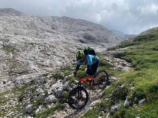
Altopiano delle Pale di San Martino
Author
Place
Italy - Veneto, BL
Km
79,97 km
Elapsed time
26:57:32
Vertical meters
+3 890 mt (610 - 2574)
Route difficulty
Landscapes
Last update
2023/09/30 17:59:10
Comments
Hotels
Description
Fantastic route straddling Veneto and Trentino, very challenging both physically and technically, with important and exciting descents. From the arrival of the Rosetta cable car it is 2100 meters of descent to Agordo, with many variants also very technical in the final part. The ascent is on asphalt up to the Cereda pass then on trails and dirt roads to San Martino. From San Martino to Rosetta it is 1000 meters with lift.
Local weather
Thu 00:00

19 °C
Thu 12:00

26 °C
Fri 00:00
22 °C
Fri 12:00
25 °C
Sat 00:00

17 °C
Sat 12:00
26 °C


Graph
Nearest Routes
47,30 km
Km
+1 900 mt
Vertical meters
Route difficulty
Landscapes
35,91 km
Km
+2 048 mt
Vertical meters
Route difficulty
Landscapes
78,08 km
Km
+3 250 mt
Vertical meters
Route difficulty
Landscapes
55,40 km
Km
+3 000 mt
Vertical meters
Route difficulty
Landscapes
21,37 km
Km
+1 140 mt
Vertical meters
Route difficulty
Landscapes
10,61 km
Km
+474 mt
Vertical meters
Route difficulty
Landscapes
2022/11/03
- Italy - Veneto, BL 48,07 km
Km
+1 460 mt
Vertical meters
Route difficulty
Landscapes
12,11 km
Km
+80 mt
Vertical meters
Route difficulty
Landscapes
15,54 km
Km
+702 mt
Vertical meters
Route difficulty
Landscapes
24,84 km
Km
+1 167 mt
Vertical meters
Route difficulty
Landscapes