Italiano
 Deutsch
Dosso dei Morti Monte Corona

This superlative cyclo-mountaineering trip kicks off about 1.5 km from the town of Roncone (TN) in the direction of Bondone Valley (I put on the navigator Miramonti Restaurant) at an abrupt left turn on the road that instead proceeds straight for Bondone Valley (it will be our return) there is plenty of comfortable space for cars.
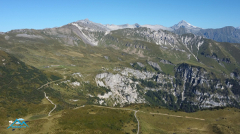
Ready to go and we set off uphill on paved forestry that between alpine pastures woods and clearings with a few deadly ramps leads us up to the beautiful Avalina hut. We covered 8.2 km and an elevation gain of 940 meters. From here, paraphrasing the supreme poet "leave all hope behind you who pedal" because for the remaining 5.4 km and 600 meters of elevation gain ( except for two fun descents) you push or shoulder the bike. You now climb with difficulty on the Dosso dei Morti first on a comfortable dirt road then bending to the right you leave it for a path marked on the navigator but not on the ground to the point that for a stretch I stopped following it keeping as azimuth the CAI red-white apex posts. This condition lasts very little because then the path becomes well marked on the ground and there is no possibility of misunderstanding running always close to the ridge and with only one fork, so ahead even without checking the navigator.
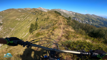
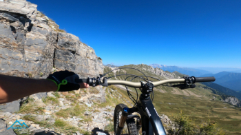
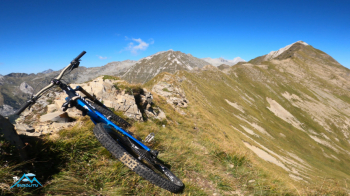
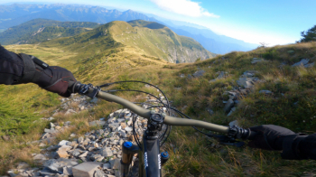
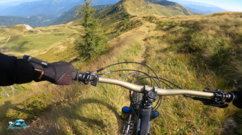
There is nothing left but to ride along this endless ridge enjoying the sublime views it gives us, also because on the way back our focus will be on bike handling as there is no lack of technical segments but also easy and for this reason fast so only now we are given to enjoy the view. Looking from afar this marvelous pyramid seems unwilling to be climbed by bike , instead when tested it turns out to be less challenging than expected, at least this is the feeling I got from it. The summit is heavenly, it gives that feeling of well-being that you don't always find even at higher elevations, altitude is not everything.
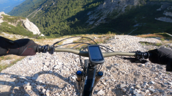
The return trip is a blast, the endless ridge is 90-95% rideable and great fun, the segment down to the Stabol Fresco hut is decidedly wild but still cyclable. From the Stabol Freaco we descend again with fun on scree that is never difficult then a beautiful path in a mature forest to the long grassy valley floor that traveled by bike doesn't seem that long but to be considered that the bike in those meadows travels very, very fast.
We thus reach the alpine village of Bondone di Sopra and from here with 1.5 km on paved forestry we quickly reach the parking place. Mt. Corona I had already climbed with Stefano via the spectacular Passo del Frate, this alternative route, passing through Dosso dei Morti and Corno Vecchio, has nothing to envy to the previous one, while the descent, this one was more fun although in both cases it always remains a splendid excursion.