Femminamorta
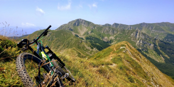
"Fast" version of the classic Femminamorta loop (1885 meters above sea level) in the Tuscan-Emilian Apennines. Valuable alternative for those who have a few hours at their disposal and want to avoid the classic "back-to-back" loop. Leaving from Ponte a Gaio, near the restaurant "Nido dell'Aquila" at the gates of the Orrido di Botri Reserve, go up the Val Fegana provincial road. This is a little (sometimes not at all) busy mountain road, paved as far as the Casentini Forest Shelter, after which it becomes a pleasant dirt road with a constant and never excessive slope as far as Foce a Giovo (1674 meters - I believe this is the highest driveway pass in the Tuscan-Emilian Apennines). Afterwards, take the trail in the direction of Hannibal Pass (1798 meters), with sections that are rideable to sections where you have to carry your bike on your back. From the pass to the summit of Femminamorta it is all shoulder biking for about 100 meters of elevation gain. From the summit, needless to say, the views are exquisite. The view ranges from the peaks that surround the Val di Luce (such as Tre Potenze, Gomito and the long ridge of Balzo delle Rose), to the peaks of the Giovo/Rondinaio group.
The descent is by following the Femminamorta ridge in a westerly direction (be careful: some sections exposed and others steep) back to Foce a Giovo. Since I had little time, instead of following the CAI 16 trail all the way from Foce (thus also passing through the CAI Lucca's Mercatello hut ), I take it much lower down; for those who have more time available, I recommend doing it all of course. At the end of the trail we are again in Ponte a Gaio.


 Italiano
 Deutsch