
 Italiano
 Deutsch
Monte Muffetto dalla Val Camonica e spettrale DH 725
The DH of the 725 trail, mark it well but do it only if you are convinced you are looking for roughness (it coincidentally starts at the Rognone bump), if you like sinister, extreme, endless things. If you like vertical woods, escarpments. You will descend into the circle of hell (after all, the valley that runs alongside is called just that) and before you start don't forget to put on your diaper, you will need it.
It's not all bikeable downhill, a good part of it is, provided you possess great technique, safe riding and some hair. Adrenaline at ten thousand and wrist pain guaranteed, as is exposure. I am satisfied to have closed so many sequences at the limit but mostly to have made it to the bottom in one piece.
This trail represents the second part of the descent and is avoidable by continuing from Dosso Rognone down the mule track to Fucine, Montecchio.
For the rest, splendid cycle-mountaineering tour (stretches with bike on shoulder) with ascent to the scenic summit of Muffetto, Dosso Sparviero and Dosso Blussega.
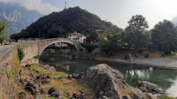
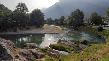
Departure from Montecchio, hamlet of Darfo Boario Terme, 220 meters (parking at the parish church). After a quick visit to the old bridge and the beautiful bend in the Oglio River, we move to Artogne, where the less frequented paved climb begins, passing through Acquebone, among chestnut and beech woods, to Montecampione. Just before reaching this locality, at an altitude of 1000, you cut through a forestry road that with two, three steep ramps leads to the road to the Plan (1736 meters).
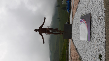
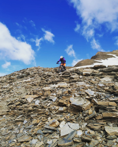
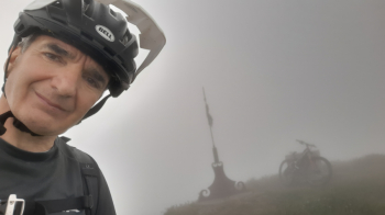
After a moment of emotion in front of the statue of the Pirate, bypassing the ecomoster we head to the Cimosco refuge, 1805 meters. Very short descent on trail to resume the ascent to Stanga del Bassinale, 1897 meters. From here a steep, narrow path leads (bike on your back) to the northern ridge of Mount Muffetto, you climb it to the summit, 2062 meters.
The descent begins by retracing the ridge and continuing over the small path back to the Stanga. Reaching, just below, a saddle, turn left reaching the dirt road that shortly leads back to Stanga del Bassinale. From here turn right to reach Malga Paglia. Via path you reach Dosso Sparviero (short shoulder/push), 1893 meters.
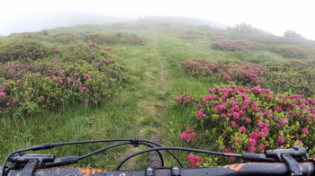
A nice trail leads to malga Piazza la Nera, 1670 meters, another equally nice trail leads to malga Cauzzo, 1620 meters. From here, bike back up the ridge (scant trail) to Dosso Blussega, 1811 meters (panorama).
Following the wide, grassy northern ridge you reach a saddle just before Colmet where you drop slightly to the left (west) taking a trail that leads shortly to Malga Perlepere. By a mule track you reach Dosso Rognone, 1458 meters (panorama of upper Lake Iseo). Continuing along the mule track you can reach the valley floor with little adrenaline.
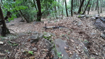
At the fountain, on the right begins among the grass the infamous path 725. Entering the steep, ghostly woods, one has crossed the threshold, leaving all hope [cit.] Given the context and the (let's call it) trail, one feels like turning back, except that pride and curiosity dictate continuing. Having passed (on foot) a traverse, the first section of the dark side of the descent, we get on the pedals. From now on it will be a succession of "cyclable" stretches (hairpin bends, trialistic on steep and narrow path with frequent technical passages that needs safe and precise riding), often on the limit, alternating with short stretches to be done on foot (forbidden to fall and roll down, no one would find us again).
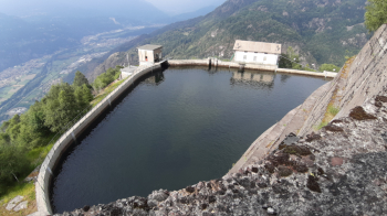
Reaching the suspended, artificial Resio Basin, 1067 meters, one wonders (even more) "and now where do we go down?" Past a short, uncomfortable stretch on foot, the game resumes. The fatigue is not only physical but also lies in holding the tension, the concentration is always maximum. The "game" ends at the bottom of the valley at the Resio hydroelectric power plant.
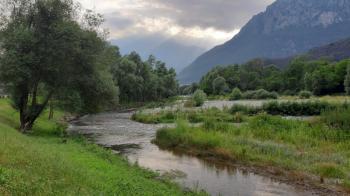
Via the beautiful South Oglio bicycle and pedestrian path, we discharge the accumulated tension and return to the starting point


