HOME RANKINGS CHALLENGES ROUTES NEAR ME PLANNING SEARCH LOGIN
Italy - Toscana, FI
2023/06/28 09:33:48

Via degli Dei giorno 2

16 Downloads
0
 
Share
Author
Strauss
(7)
Place
Italy - Toscana, FI
Km
32,44 km
Elapsed time
06:22:38
Vertical meters
+820 mt (315 - 1215)
Route difficulty
Landscapes
Last update
2023/06/28 10:03:04
Comments
0
Description

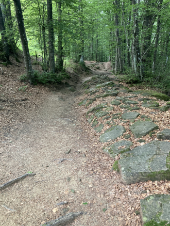
We start again from Madonna dei Fornelli immediately with a nice climb first on asphalt then off-road that takes us up to Monte dei Cucchi with some well-marked detours for Mtb. From there we continue without too much change in altitude to Pian di Balestra and to follow to the Ossi plain thus entering Tuscany. The route continues to wind through the woods on fairly technical and fun trails and climbs to le Banditacce at 1200 m a.s.l., the highest point of the entire route. From here you begin to descend and through a fairly technical descent among the stones you reach the Passo della Futa. From here you start climbing again until you get close to Monte Gazzaro, which cannot be climbed by Mtb (not recommended and with a special detour).

From here continue up and down on trail and scree until Osteria Bruciata and then continue downhill always off-road with quite technical sections in consideration of having fairly loaded Mtb travelers. After a long gravel descent you arrive at the end of the second stage in Sant'Agata, personally this was my favorite part of the route.

Day 1

Day 3

Download our free mobile app to send this route to your Garmin device or to navigate it on OSM maps. Android - iOS
Local weather
Today
17 °C
Tonight
8 °C
Tomorrow
15 °C
Tomorrow night
7 °C
Thursday
15 °C
Thursday night
8 °C
Friday
16 °C
Friday night
9 °C
Saturday
17 °C
Saturday night
8 °C

Graph

Nearest Routes

2023/12/07
- Italy - Emilia-Romagna, BO
23,11 km
Km
+570 mt
Vertical meters
Route difficulty
Landscapes
2023/12/07
- Italy - Emilia-Romagna, BO
20,17 km
Km
0 mt
Vertical meters
Route difficulty
Landscapes
2024/08/12
- Italy - Emilia-Romagna, BO
18,11 km
Km
+718 mt
Vertical meters
Route difficulty
Landscapes
2023/12/07
- Italy - Emilia-Romagna, BO
18,23 km
Km
+641 mt
Vertical meters
Route difficulty
Landscapes
2023/12/07
- Italy - Emilia-Romagna, BO
19,43 km
Km
+728 mt
Vertical meters
Route difficulty
Landscapes
2025/02/08
- Italy - Emilia-Romagna, BO
16,42 km
Km
+650 mt
Vertical meters
Route difficulty
Landscapes
2025/04/18
- Italy - Emilia-Romagna, BO
22,18 km
Km
+700 mt
Vertical meters
Route difficulty
Landscapes
2023/12/24
- Italy - Emilia-Romagna, BO
Paoloc1
(75)
24,36 km
Km
+1 350 mt
Vertical meters
Route difficulty
Landscapes
2023/12/07
- Italy - Emilia-Romagna, BO
26,15 km
Km
0 mt
Vertical meters
Route difficulty
Landscapes
2023/12/07
- Italy - Emilia-Romagna, BO
21,58 km
Km
0 mt
Vertical meters
Route difficulty
Landscapes

0 Comments