HOME RANKINGS CHALLENGES ROUTES POI PLANNING SEARCH LOGIN
Italy - Toscana, PT
2023/06/23 10:50:16

Pracchia - Monte Cavallo - Portafranca

2 Downloads
0
 
Share
Author
Place
Italy - Toscana, PT
Km
41,43 km
Elapsed time
00:00:00
Vertical meters
+1 500 mt (516 - 1639)
Route difficulty
Landscapes
Last update
2023/07/26 09:43:02
Comments
0
Description

The itinerary starts from the station in Pracchia, we ride 6-7 km slightly downhill on asphalt, then turn left and begin to climb towards the locality Casa Boni, the pedigrees are quite challenging especially in the initial part. After a few km the asphalt gives way to dirt road and we climb to Monte Cavallo on a comfortable forest road. We arrive on the ridge and follow the dirt road that then becomes a path in the shade of the dense forest, we find a few uphill climbs but nothing technical until we reach the Portafranca Refuge where it is mandatory to eat a slice of raspberry tart (picked 50 meters up).
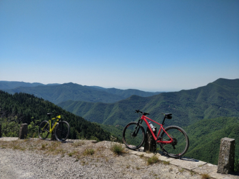
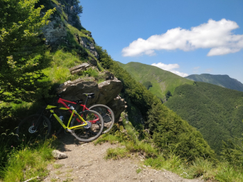
Behind the hut we take the path that climbs between raspberry plants and becomes a narrow track at times not very rideable that continues on the ridge. We begin to descend finding a beautiful view of the surrounding mountains and the Pistoia plain.
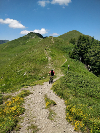
The trail then descends through the always cool Teso Forest returning to the starting point. This tour except for a few passages is technically quite easy and pleasant to ride even with a front.

Download our free mobile app to send this route to your Garmin device or to navigate it on OSM maps. Android - iOS
Local weather
°C
°C
°C
°C
°C
°C
°C
°C
°C
°C

Graph

Nearest Routes

2023/07/10
- Italy - Toscana, PT
41,00 km
Km
+1 300 mt
Vertical meters
Route difficulty
Landscapes
2024/08/19
- Italy - Toscana, PT
ebsat
(107)
33,47 km
Km
+1 749 mt
Vertical meters
Route difficulty
Landscapes
2023/01/06
- Italy - Toscana, PT
ebsat
(107)
28,08 km
Km
+1 564 mt
Vertical meters
Route difficulty
Landscapes
2023/07/10
- Italy - Emilia-Romagna, BO
ebsat
(107)
36,13 km
Km
+1 570 mt
Vertical meters
Route difficulty
Landscapes
2023/01/17
- Italy - Emilia-Romagna, BO
ebsat
(107)
27,55 km
Km
+2 207 mt
Vertical meters
Route difficulty
Landscapes
2024/06/14
- Italy - Emilia-Romagna, BO
ebsat
(107)
25,40 km
Km
+1 656 mt
Vertical meters
Route difficulty
Landscapes
2023/12/30
- Italy - Emilia-Romagna, BO
CornoBike
(3)
31,29 km
Km
+1 410 mt
Vertical meters
Route difficulty
Landscapes
2023/03/02
- Italy - Toscana, LU
giobike73
(49)
38,44 km
Km
+1 385 mt
Vertical meters
Route difficulty
Landscapes
2024/01/28
- Italy - Emilia-Romagna, BO
CornoBike
(3)
32,32 km
Km
+1 340 mt
Vertical meters
Route difficulty
Landscapes
2024/06/09
- Italy - Emilia-Romagna, BO
Paoloc1
(60)
30,53 km
Km
+1 700 mt
Vertical meters
Route difficulty
Landscapes

0 Comments