Romana, salita per Solva, sentiero del Nocciolo
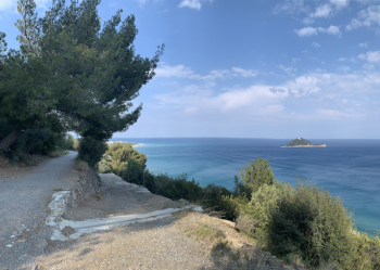
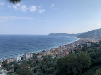
I propose this route, which will probably be overwhelmingly familiar to many locals, attaching, however, a few photos of the first decidedly scenic part.
The start of the trail is Villanova d'Albenga, but if you wish you can start from the town of Albenga and intercept the trail from this smiling seaside town. It climbs up to take the ancient Via Romana, a dirt road that runs along the Aurelia from above, with an extremely scenic and evocative route over the sea. The Gallinara sole is at its best in the evening hours, with enchanting light color. The dirt road presents no difficulty, it is pleasant with ups and downs, just a few points to be a little careful but really nothing difficult, it can be tackled with any bicycle.

This takes us all the way to Alassio, precisely above the marina, where one can pause for the usual photos and refresh oneself at a little fountain in the little terrace overlooking the port.

From this point, you can turn back from the same road or go down to Alassio and back from the Aurelia, or go on and up the Solva road, where the difficulty of the climb begins a bit. Very beautiful and scenic landscapes. The climb to the top is all on paved road, very little traffic, very quiet.

You go up in absolute tranquility and silence, surrounded by small houses, stone cottages and olive trees, terracing landscaped to the smallest detail. I gave 3 stars of difficulty, because it is a long climb with some steep sections, you climb with an average I would say between 9 and 12% with peaks even at 16% but these are only very few hundred meters. You can also get as far as Madonna della Guardia and then descend back to Alassio always on a paved road and always very panoramic.
However, having arrived almost at the top, my track takes a path called the Hazel, very nice and smooth, cleaned up to perfection recently. Just a little technical in the very stony and steep final part. I return to Villanova d'Albenga with two options: the Marta trail, or the asphalt road with panoramic views of the valley.


 Italiano
 Deutsch