Italiano
 Deutsch
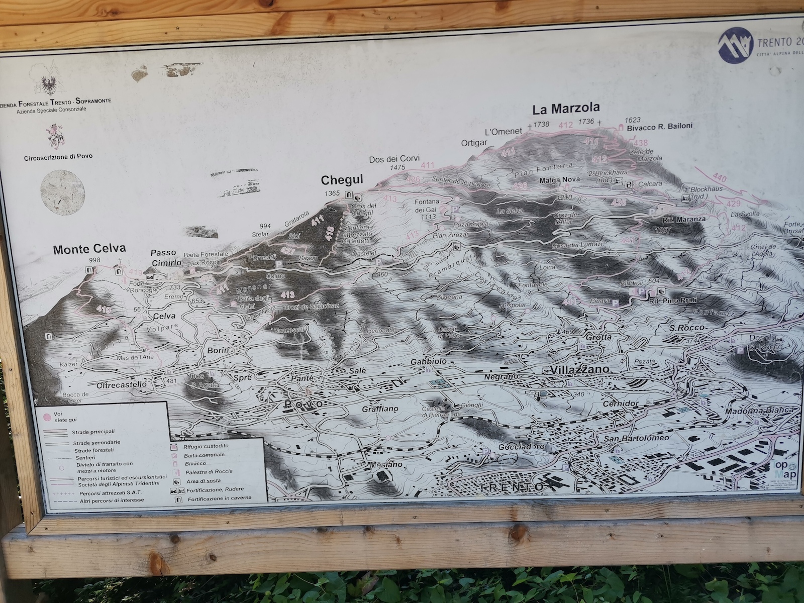
La Marzola - Chegul - 411

Fun itinerary on the heights of Trento, very steep climb in places and varied descent between bumps and switchbacks.
Departure from the parking lot of the Povo nursing home, climb to the Cimirlo pass and continue to Rif. Maranza. In the flat section we leave the asphalt road to make the direct ascent on the forestal road of the Gai fountain that arrives at Chegul with an ascent always on an excellent bottom. Those who want can get to Chegul by a longer but enjoyable route via Rif. Maranza, Malga Nova and then traversing to Chegul by the Sheep Trail (a few steps on foot).
From Chegul continue uphill on really steep inclines at times (hard not to push a few short sections!) to Sella Marzola. From the Sella nice panoramic trail with a final push up to the summit cross with views of Valsugana.

From the summit descend on the opposite side with a very fun trail that offers a few steep nose press switchbacks back to the uphill forest road. Descend and at a fork follow the path that climbs to Dos dei Corvi between the trenches and then continue on the ridge and then rejoin the forestry on a path that is not very evident among the leaves, be careful not to descend on inviting path to the right.
Returning to Chegul, continue north on the forest road until you take path 411 that has a nice series of more or less narrow hairpin bends with a sometimes rocky bottom but always very enjoyable, then it becomes more flowing until you reach the fork that we follow to the left that takes us onto a nice up and down path that is always cyclable, except for a short ramp, then we descend on the road to Maranza.
Crossing the road we enter path 427 initially narrow with a bumpy bottom, then it improves and widens to end up on forestry which we follow to the right and which again becomes a fun and sometimes bumpy path. At a house, instead of descending on the road we turn left on a bumpy trail that takes us to Borino and shortly to the starting point.