HOME RANKINGS CHALLENGES ROUTES NEAR ME PLANNING SEARCH LOGIN
Italy - Liguria, GE
2023/03/07 08:32:05

Anello Monte Moneglia

7 Downloads
0
 
Share

Key Takeaways / Scheda Tecnica

Disciplina:
Mountain Bike (MTB)
Percorso:
Anello Monte Moneglia
Località:
Italy - Liguria, GE
Distanza:
11,13 km
Dislivello Positivo:
+612 mt (Quota Min: 21m - Max: 498m)
Difficoltà Tecnica:
4/5
Valutazione Panorami:
5/5
Formato Traccia:
GPX Download disponibile
Author
Antosangui
(121)
Place
Italy - Liguria, GE
Km
11,13 km
Elapsed time
00:00:00
Vertical meters
+612 mt (21 - 498)
Route difficulty
Landscapes
Last update
2023/03/07 08:44:14
Comments
0
Description

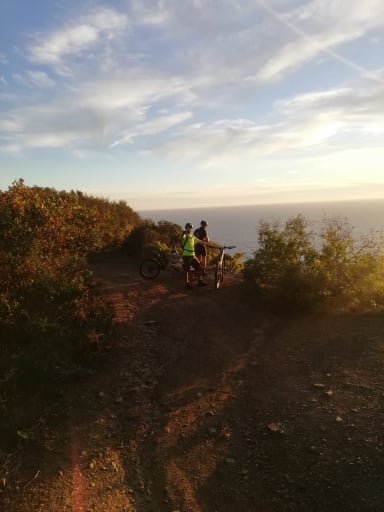
Depart from Moneglia for this loop on the mountain of the same name.

Start at the station and follow the ascent to Crova; at the fork, keep left and thus reach the Bracco road, which you take to the left. Immediately you have to take the path on the left, which alternates between pieces where you can pedal and many other pieces where portage becomes essential. At the fork in the trail take a right uphill. When you reach the top of Monte Moneglia take the path to the left downhill and be prepared for a very technical descent that will lead you to Colle del Lago.

Here you will find picnic tables, take the path to the left and begin the return to Moneglia. This part also has some portage sections; the sections that are doable by bike are technical. You will thus arrive in the hamlet of Venino, continue downhill and you will be back from the station.

Very technical tour, be careful if you are intent on following it in hot weather, as the part of the return to Moneglia is exposed to the sun and can be very trying, also there are no points to refuel with water.

Download our free mobile app to send this route to your Garmin device or to navigate it on OSM maps. Android - iOS
Local weather
Mar 00:00
18 °C
Mar 12:00
21 °C
Mer 00:00
20 °C
Mer 12:00
20 °C
Gio 00:00
18 °C
Gio 12:00
21 °C
Ven 00:00
16 °C
Ven 12:00
19 °C
Sab 00:00
16 °C
Sab 12:00
15 °C

Graph

Nearest Routes

2023/03/02
- Italy - Liguria, GE
Antosangui
(121)
17,49 km
Km
+640 mt
Vertical meters
Route difficulty
Landscapes
2023/03/02
- Italy - Liguria, GE
Antosangui
(121)
12,30 km
Km
+421 mt
Vertical meters
Route difficulty
Landscapes
2023/03/07
- Italy - Liguria, GE
Antosangui
(121)
22,75 km
Km
+778 mt
Vertical meters
Route difficulty
Landscapes
2023/03/02
- Italy - Liguria, GE
Antosangui
(121)
19,07 km
Km
+725 mt
Vertical meters
Route difficulty
Landscapes
2023/03/02
- Italy - Liguria, GE
Antosangui
(121)
16,53 km
Km
+890 mt
Vertical meters
Route difficulty
Landscapes
2023/03/03
- Italy - Liguria, GE
Antosangui
(121)
17,77 km
Km
+680 mt
Vertical meters
Route difficulty
Landscapes
2023/01/15
- Italy - Liguria, SP
ebsat
(129)
31,06 km
Km
+1 129 mt
Vertical meters
Route difficulty
Landscapes
34,75 km
Km
+1 322 mt
Vertical meters
Route difficulty
Landscapes
2024/02/20
- Italy - Liguria, SP
ebsat
(129)
41,26 km
Km
+1 450 mt
Vertical meters
Route difficulty
Landscapes
2023/03/05
- Italy - Liguria, SP
Antosangui
(121)
19,01 km
Km
+652 mt
Vertical meters
Route difficulty
Landscapes

0 Comments