HOME RANKINGS CHALLENGES ROUTES POI PLANNING SEARCH LOGIN
Italy - Trentino-Alto Adige/Südtirol, BZ
2023/03/06 21:02:43

Sentieri a sud di San Candido

8 Downloads
2
 
Share
Author
nonnocarb
(292)
Place
Italy - Trentino-Alto Adige/Südtirol, BZ
Km
30,64 km
Elapsed time
02:51:58
Vertical meters
+890 mt (1172 - 1722)
Route difficulty
Landscapes
Last update
2023/03/07 14:19:42
Comments
0
Description

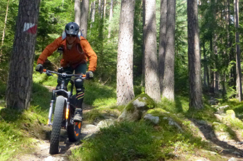
Itinerary with beautiful views of San Candido and its mountains. Quite challenging, both for the steep climbs and for the path on the coast that is quite narrow and with some exposed sections, though never dangerous.
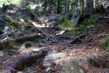
From the Olympia camping site you arrive in San Candido on the bike path, then climb to Mount Elmo, deviating, however, to the right on the beautiful path to Sesto. You then descend on the bike path to the junction with the San Candido springs. From here you climb with steep sections to the Baranci, then continue to the top of the ski lift and take the nice trail that runs at an elevation of 1700 meters paassing a couple of hunter's huts. After a descent, climb hard up to the Baumgartner Kaser, which is very nice with refreshments, and descend on the forest path to the valley. On the bike path back to the campsite.
Download our free mobile app to send this route to your Garmin device or to navigate it on OSM maps. Android - iOS
Local weather
°C
°C
°C
°C
°C
°C
°C
°C
°C
°C

Graph

Nearest Routes

2022/10/22
- Italy - Trentino-Alto Adige/Südtirol, BZ
nonnocarb
(292)
20,17 km
Km
+1 136 mt
Vertical meters
Route difficulty
Landscapes
2023/03/04
- Italy - Trentino-Alto Adige/Südtirol, BZ
nonnocarb
(292)
55,01 km
Km
+1 450 mt
Vertical meters
Route difficulty
Landscapes
2023/03/05
- Italy - Trentino-Alto Adige/Südtirol, BZ
nonnocarb
(292)
28,95 km
Km
+1 110 mt
Vertical meters
Route difficulty
Landscapes
2023/02/26
- Italy - Trentino-Alto Adige/Südtirol, BZ
nonnocarb
(292)
34,09 km
Km
+1 420 mt
Vertical meters
Route difficulty
Landscapes
2023/03/05
- Italy - Trentino-Alto Adige/Südtirol, BZ
nonnocarb
(292)
46,65 km
Km
+450 mt
Vertical meters
Route difficulty
Landscapes
2023/03/05
- Italy - Trentino-Alto Adige/Südtirol, BZ
nonnocarb
(292)
34,64 km
Km
+1 320 mt
Vertical meters
Route difficulty
Landscapes
2023/03/05
- Italy - Trentino-Alto Adige/Südtirol, BZ
nonnocarb
(292)
33,21 km
Km
+750 mt
Vertical meters
Route difficulty
Landscapes
2022/10/28
- Italy - Trentino-Alto Adige/Südtirol, BZ
nonnocarb
(292)
48,18 km
Km
+1 684 mt
Vertical meters
Route difficulty
Landscapes
2023/03/01
- Italy - Trentino-Alto Adige/Südtirol, BZ
nonnocarb
(292)
48,18 km
Km
+1 500 mt
Vertical meters
Route difficulty
Landscapes
2023/02/26
- Italy - Trentino-Alto Adige/Südtirol, BZ
nonnocarb
(292)
22,60 km
Km
+1 100 mt
Vertical meters
Route difficulty
Landscapes

0 Comments