HOME RANKINGS CHALLENGES ROUTES POI PLANNING SEARCH LOGIN
Italy - Trentino-Alto Adige/Südtirol, BZ
2023/03/06 20:49:14

Monte Elmo, Erla trail e Croda Rossa

24 Downloads
1
 
Share
Author
nonnocarb
(292)
Place
Italy - Trentino-Alto Adige/Südtirol, BZ
Km
29,85 km
Elapsed time
05:16:12
Vertical meters
+1 700 mt (1309 - 2403)
Route difficulty
Landscapes
Last update
2023/03/07 12:03:53
Comments
0
Description

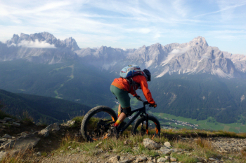
Very challenging itinerary, both for the long, steep climbs and the technical descents; in return, the views are exceptional and endless. From Sesto you climb to the arrival of the cable car and then to the top of Mount Elmo with fantastic views. You descend on the 4a (lately with bike ban, but just be respectful of pedestrians) to the forestry.
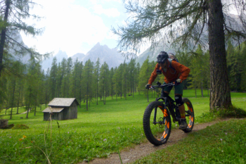
Take a left to the beginning of the new "Erla" trail reserved for bikes. You descend through the forest with challenging sections to the valley floor. The "Stiergarten" lift takes you to the beginning of the "Erla" trail if you want to do it all over again from the beginning.
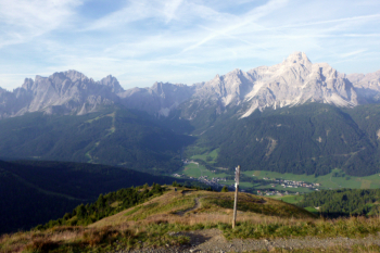
Instead, the trail goes up the opposite side, with steep sections on the toboggan run, to Croda Rossa and the hut (refreshment). Now descend on the trail down to Piano Fiscalino, which is very challenging and technical (easier variant, descend a section of forestry below the gondola on the sled track and take trail 15). In the Fiscalina valley, follow the beautiful trail 1a to Sesto.

Expert itinerary
Download our free mobile app to send this route to your Garmin device or to navigate it on OSM maps. Android - iOS
Local weather
Today
5 °C
Tonight
-6 °C
Tomorrow
6 °C
Tomorrow night
-2 °C
Tuesday
5 °C
Tuesday night
1 °C
Wednesday
6 °C
Wednesday night
-2 °C
Thursday
5 °C
Thursday night
-6 °C

Graph

Nearest Routes

2023/02/26
- Italy - Trentino-Alto Adige/Südtirol, BZ
nonnocarb
(292)
24,89 km
Km
+790 mt
Vertical meters
Route difficulty
Landscapes
2023/03/08
- Italy - Trentino-Alto Adige/Südtirol, BZ
civi65
(105)
30,41 km
Km
+1 000 mt
Vertical meters
Route difficulty
Landscapes
2022/09/17
- Italy - Trentino-Alto Adige/Südtirol, BZ
steve-U
(23)
41,63 km
Km
+1 879 mt
Vertical meters
Route difficulty
Landscapes
2023/02/26
- Italy - Trentino-Alto Adige/Südtirol, BZ
nonnocarb
(292)
22,50 km
Km
+850 mt
Vertical meters
Route difficulty
Landscapes
2024/06/06
- Italy - Trentino-Alto Adige/Südtirol, BZ
30,63 km
Km
+1 400 mt
Vertical meters
Route difficulty
Landscapes
2023/02/26
- Italy - Trentino-Alto Adige/Südtirol, BZ
nonnocarb
(292)
17,34 km
Km
+1 000 mt
Vertical meters
Route difficulty
Landscapes
2023/03/07
- Italy - Trentino-Alto Adige/Südtirol, BZ
nonnocarb
(292)
44,46 km
Km
+1 400 mt
Vertical meters
Route difficulty
Landscapes
2023/03/01
- Italy - Trentino-Alto Adige/Südtirol, BZ
nonnocarb
(292)
135,06 km
Km
+3 800 mt
Vertical meters
Route difficulty
Landscapes
2023/09/01
- Italy - Trentino-Alto Adige/Südtirol, BZ
47,62 km
Km
+1 550 mt
Vertical meters
Route difficulty
Landscapes
2023/03/02
- Italy - Trentino-Alto Adige/Südtirol, BZ
civi65
(105)
43,07 km
Km
+1 550 mt
Vertical meters
Route difficulty
Landscapes

0 Comments