
 Italiano
 Deutsch
2023/03/05 07:52:53
Giro sulla Calvana
Author

Place
Italy - Toscana, FI
Km
34,85 km
Elapsed time
06:42:16
Vertical meters
+1 150 mt (58 - 822)
Route difficulty
Landscapes
Last update
2023/03/06 07:48:40
Comments
Hotels
Description
From the parking lot we climb with some very steep sections to Mount Cantagrillo with beautiful views of the hills around Florence.
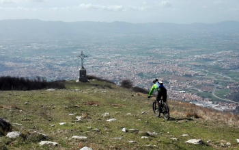
From here there is a very nice stretch on the ridge, up and down meadow and path, to the Pozza cross, with beautiful panoramic views of Prato and the plain below.
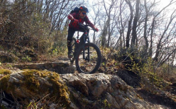
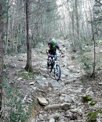
Take trail 28, initially only with technical sections, then into the woods with challenging but very fun steps. Pass through Prato for a beer, then climb up via casa Rossa and podere S. Anna. From here a nice descent, with some very technical sections, takes us back to the parking lot.
Local weather
Thu 00:00

26 °C
Thu 12:00
30 °C
Fri 00:00
26 °C
Fri 12:00
33 °C
Sat 00:00
26 °C
Sat 12:00

32 °C


Graph
Nearest Routes
31,20 km
Km
+1 197 mt
Vertical meters
Route difficulty
Landscapes
43,36 km
Km
+1 839 mt
Vertical meters
Route difficulty
Landscapes
48,96 km
Km
+2 100 mt
Vertical meters
Route difficulty
Landscapes
35,53 km
Km
+1 600 mt
Vertical meters
Route difficulty
Landscapes
2024/02/04
- Italy - Toscana, FI 28,66 km
Km
+1 034 mt
Vertical meters
Route difficulty
Landscapes
36,45 km
Km
+1 460 mt
Vertical meters
Route difficulty
Landscapes
34,21 km
Km
+1 400 mt
Vertical meters
Route difficulty
Landscapes
31,67 km
Km
+1 260 mt
Vertical meters
Route difficulty
Landscapes
31,20 km
Km
+1 500 mt
Vertical meters
Route difficulty
Landscapes
40,39 km
Km
+1 800 mt
Vertical meters
Route difficulty
Landscapes