2023/03/04 21:00:24
Cornetto di confine e Thurntaler
Author
Place
Italy - Trentino-Alto Adige/Südtirol, BZ
Km
55,01 km
Elapsed time
05:21:13
Vertical meters
+1 450 mt (1077 - 2514)
Route difficulty
Landscapes
Last update
2023/03/04 22:00:35
Comments
Description
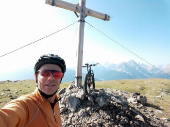
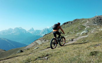
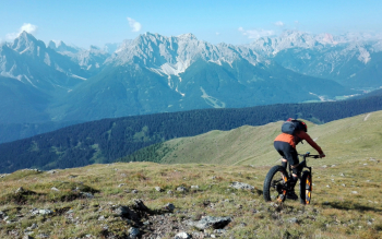
Very challenging tour but great for views and very satisfying for downhill trails.

From Dobbiaco go up the San Silvestro valley, taking the forest road to the orographic left of the stream, very steep initially (or follow the normal road). At the San Silvestro alpine hut go up the wide military road, not difficult but long, to the border cornet.

From here a long up and down, among stupendous and wild views, to the Thurntaler ski lifts. Now begins the descent on the 7 to Sillian, with steep but still beautiful sections. Back to Toblach on bicycle path.

Local weather
Today

20 °C
Tonight

8 °C
Tomorrow

19 °C
Tomorrow night

6 °C
Sunday

18 °C
Sunday night

8 °C
Graph
Nearest Routes
20,17 km
Km
+1 136 mt
Vertical meters
Route difficulty
Landscapes
28,95 km
Km
+1 110 mt
Vertical meters
Route difficulty
Landscapes
30,64 km
Km
+890 mt
Vertical meters
Route difficulty
Landscapes
2023/02/26
- Italy - Trentino-Alto Adige/Südtirol, BZ 34,09 km
Km
+1 420 mt
Vertical meters
Route difficulty
Landscapes
2023/03/05
- Italy - Trentino-Alto Adige/Südtirol, BZ 46,65 km
Km
+450 mt
Vertical meters
Route difficulty
Landscapes
34,64 km
Km
+1 320 mt
Vertical meters
Route difficulty
Landscapes
33,21 km
Km
+750 mt
Vertical meters
Route difficulty
Landscapes
48,18 km
Km
+1 684 mt
Vertical meters
Route difficulty
Landscapes
48,18 km
Km
+1 500 mt
Vertical meters
Route difficulty
Landscapes
22,60 km
Km
+1 100 mt
Vertical meters
Route difficulty
Landscapes


 Italiano
 Deutsch