2023/03/04 10:22:25
Cima Hintereis val Senales
Author
Place
Italy - Trentino-Alto Adige/Südtirol, BZ
Km
28,35 km
Elapsed time
07:14:20
Vertical meters
+1 500 mt (1691 - 3271)
Route difficulty
Landscapes
Last update
2023/03/04 18:23:42
Comments
Description
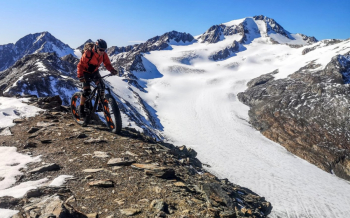
Very hard route, but in very beautiful wilderness, with final view of the Palla Bianca glacier 3728 meters.

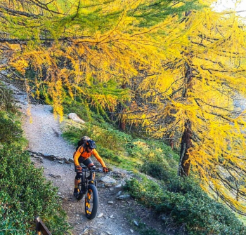
From the lake go up by road to Maso Corto, then climb along the very steep ski slope, by force of a push. Then pedal up a steep forest road to the junction with the trail, but still rideable. Last stretch of portage to the Bellavista hut. From here almost all portage to Hintereis summit, with incredible views of glaciers.

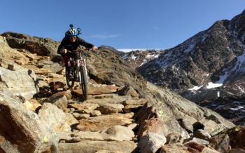
Very technical descent, but almost all cyclable and all fun until Maso Corto. Final descent by road, but having time you can take trail 7 left towards the Finale farm to the lake. Route to be done preferably out of season to meet fewer hikers on the path to the bellavista.

Local weather

°C

°C

°C

°C

°C

°C
Graph
Nearest Routes
19,65 km
Km
+1 700 mt
Vertical meters
Route difficulty
Landscapes
2025/08/12
- Italy - Trentino-Alto Adige/Südtirol, BZ 43,72 km
Km
+2 550 mt
Vertical meters
Route difficulty
Landscapes
30,40 km
Km
+1 865 mt
Vertical meters
Route difficulty
Landscapes
31,33 km
Km
+1 500 mt
Vertical meters
Route difficulty
Landscapes
2024/08/12
- Italy - Trentino-Alto Adige/Südtirol, BZ 35,58 km
Km
+1 292 mt
Vertical meters
Route difficulty
Landscapes
2024/10/29
- Italy - Trentino-Alto Adige/Südtirol, BZ 35,52 km
Km
+1 400 mt
Vertical meters
Route difficulty
Landscapes
18,66 km
Km
+1 050 mt
Vertical meters
Route difficulty
Landscapes
26,12 km
Km
+1 250 mt
Vertical meters
Route difficulty
Landscapes
51,34 km
Km
+980 mt
Vertical meters
Route difficulty
Landscapes
72,93 km
Km
+2 970 mt
Vertical meters
Route difficulty
Landscapes


 Italiano
 Deutsch