
 Italiano
 Deutsch
Sentiero Mare-Monti Joppolo
Route for mtb with departure from Nicotera. Starting from the Ciccio Lapa stadium in Nicotera, take the provincial road and turn immediately left. You pass a small residential center, and go up a paved road for about a kilometer. You take the only road on the left that you come across and descend off road to Britto locality (watch out for the reeds protruding from the sides).
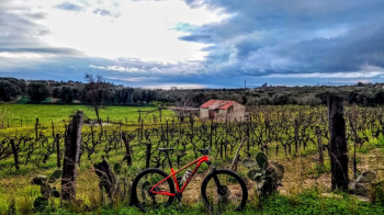
When you finish the descent, when you get to the small bridge, turn right and proceed on a dirt road, very bumpy, with many potholes, in some sections you have to get off the road and go through the earth, under the olive trees (follow the turns we leave). You will pass through vineyards and orchards, until you come to a point where you are in the middle of two walls of earth. Crossing SP28, you will proceed straight ahead, and pass by the last of the houses of Preitoni, a hamlet of Nicotera and a wine and oil village. Going uphill, you will turn left to take a small dirt shortcut that ends with a small uphill tear. At this point you will continue uphill toward Caroniti, following the road that will continue to climb. You have reached Caroniti, a hamlet of Joppolo and the beginning of the descent. Immediately after the first left turn that you will encounter, you will need to turn right. A very steep descent begins, at times unpaved with concrete sections. At the end of this descent (pay attention to the final part because you will pop up on the road trafficked by cars!), turn right and continue downhill for another 500 meters. And here comes the best part, the long-awaited dirt path.
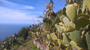
It is an entirely dirt path, consisting of many tight switchbacks, with the possibility of finding stones hidden under the vegetation, surrounded by fennel and prickly pear trees. The trail ends at Joppolo, where there is also a fountain.
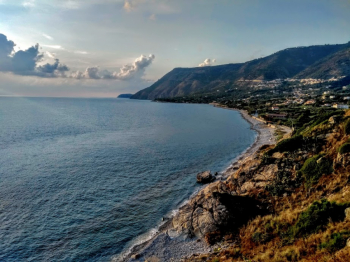
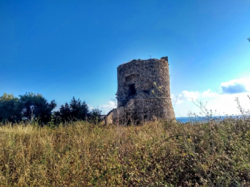
At this point, the path continues down to the sea, which, however, will see many people descend because of steps that are not within everyone's reach and the passage over a bridge created for pedestrians that passes over the tracks. Having reached the sea, one arrived at Joppolo mare, then visited Torre Parnaso.
Having visited Torre Parnaso, we set off again for the return to Nicotera via SP23, with a detour to avoid traffic, taking a small dirt road on the right that will lead almost to the starting point.


