Italiano
 Deutsch
Sul monte Baldo da Garda

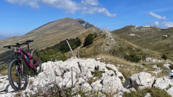
Perhaps one of the most beautiful rides you can do on Mt. Baldo, very scenic and with lots of fun trails both up and down. From #garda you climb up through the Valle dei Molini and then via trails and a short finish on a steep paved road to San Zeno. From here you climb to Prada and then begin the long climb true the slopes of Baldo to an elevation of 1560. At 1100 meters above sea level is Malga Traure, with a nice terrace and fantastic cheese and cold cuts sandwiches. Highly recommended to put something on your stomach. We climb to the highest point of the tour, just below the Naole Fort you see in the upper right of the photo below. To the left is the road up to Baldo and, if you wish, Telegraph peak.
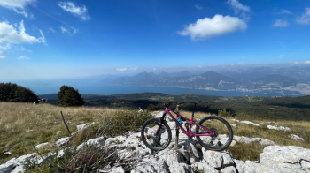
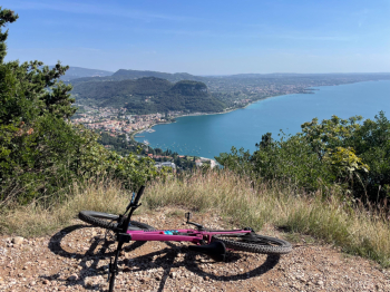
The view is fantastic and sweeps over the entire lake.
We continue briefly to the fort and then turn right onto a path in the midst of meadows and boasse typical of this area. Stringy sections alternate with classic limestone boasse (be careful in wet weather). You also pass by some abandoned alpine pastures, where there will be no shortage of nettles. In the woods the path becomes more spindly, until we reach a rutted cart track that takes us to the road from Caprino Veronese to Lumini. Short climb and if you want, in Lumini, you can refresh yourself, also because the tour is still long.
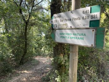
You will pass through the Sperane forest, a tangle of trails where an XC race is held once a year.
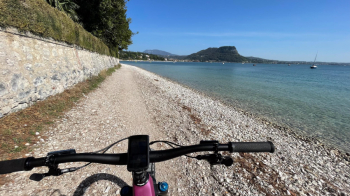
More trails, you'll climb the Luppia with beautiful views of the lake and final descent to Garda, with a beach crossing.
It's worth stopping for ice cream on the lakefront.