
 Italiano
 Deutsch
2023/02/26 13:08:13
Tracciolino
Author
Place
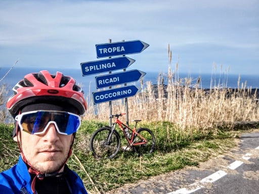
Italy - Calabria, RC
Km
7,84 km
Elapsed time
00:00:00
Vertical meters
+420 mt (271 - 575)
Route difficulty
Landscapes
Last update
2023/02/26 22:03:34
Comments
Description
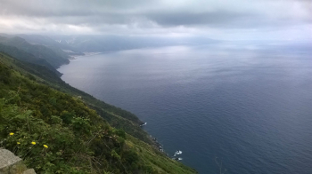
MTB excursion on the Tracciolino, a beautiful trail that starts in Palmi (RC) and arrives on Mount Sant'Elia. The trail overhangs the Viola coast, and provides a beautiful view of the Strait of Messina. Part of the tour must be done with a hand bike. Once in Sant'Elia, photo at the 3 crosses, and descend along the singletrack to Palmi. The ride is entirely on dirt road, and includes passing over old bridges. Tour that can also be done on foot.
Local weather

°C
°C
°C
°C
°C
°C
Graph
Nearest Routes
40,28 km
Km
+840 mt
Vertical meters
Route difficulty
Landscapes
37,99 km
Km
+500 mt
Vertical meters
Route difficulty
Landscapes
62,47 km
Km
+1 900 mt
Vertical meters
Route difficulty
Landscapes
55,33 km
Km
+1 990 mt
Vertical meters
Route difficulty
Landscapes
54,85 km
Km
+1 900 mt
Vertical meters
Route difficulty
Landscapes
31,84 km
Km
+250 mt
Vertical meters
Route difficulty
Landscapes
58,20 km
Km
+1 600 mt
Vertical meters
Route difficulty
Landscapes
36,46 km
Km
+1 420 mt
Vertical meters
Route difficulty
Landscapes