
 Italiano
 Deutsch
Poggio Pelato Trail Area

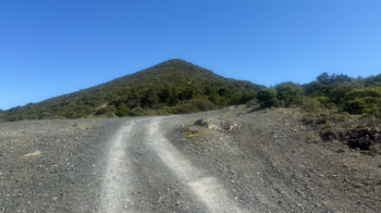
The Poggio Pelato Trail Area is located south of Livorno near Castiglioncello, right at the Castiglioncello exit of the SS1 highway, with parking available at the trailhead. Poggio Pelato is simply this hill. Trails branch off from the summit, dividing into two sections: a rockier, more technical section at the top, and a more flowing section through the woods at the bottom. The elevation gain from the parking lot to the summit is 250 meters, all of which can be covered on dirt roads. Here too, the initial climb up to the point where the photo was taken is gradual and pleasant (150 meters of elevation gain), while the final 100 meters of elevation gain are steeper and rockier. The first part of the climb can be done on a flatter, longer road (the first ascent of the trail) or a slightly steeper, shorter one.
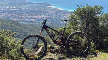
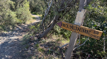
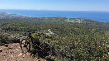
The trail takes us to the top of Poggio Pelato, where you can enjoy a beautiful view of the Tyrrhenian Sea, with a view all the way to the islands of Capraia, Elba, and Corsica on clear days. The first descent is called Belvedere, rated S2 at the top, then S1 in the woods, and it is the most varied and longest in the trail area: rocky at the top, superflow at the bottom in the woods.
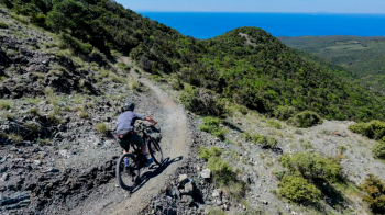
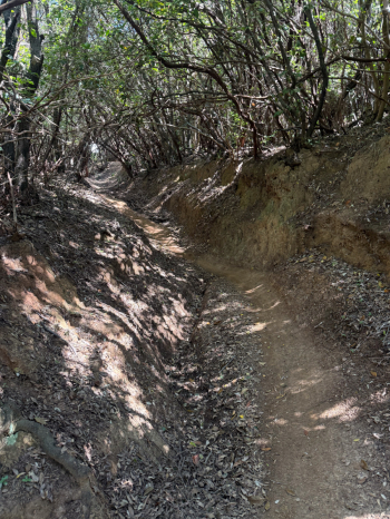
We head back up using the “short” climb and this time take Pietraia, which, as the name suggests, is very rocky and, above all, offers zero grip in dry conditions (S3). This trail isn’t necessarily recommended, but since it’s short, we head straight back up to the summit of Poggio Pelato and this time take Sir Robert, which is much more pleasant and fun. Here too, the upper section is quite rocky, while the part through the woods becomes an exhilarating high-speed trail with berms, jumps (easy), and compacted soil (S1). All the trails are exceptionally well-maintained, with excellent water management via channels and steps that are easy to clear.
Sir Robert takes us all the way to the parking lot. We climb back up Poggio Pelato and this time tackle the most technical trail in the area: La Rossa (S3). It’s a very rocky line, with steep sections and relatively tight switchbacks, ending near where Pietraia ends. We climb back up and take Sir Robert for the first part, but then we take Zago for another fast and super fun descent through the woods with the usual flow, berms, and jumps. We’ll arrive at the parking lot with about 1,000 meters of elevation gain in our legs and can choose whether to climb back up one more time.
All that’s left to say is “Well done” to those who maintain this trail area. Highly recommended!


