
 Italiano
 Deutsch
2026/01/08 20:57:16
Finale ligure 115
Author

Place
Italy - Liguria, SV
Km
4,05 km
Elapsed time
01:10:37
Vertical meters
+138 mt (804 - 1051)
Route difficulty
Landscapes
Last update
2026/01/08 21:33:09
Comments
Hotels
Description
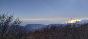
Trail from the NATO base in Finale Ligure. Short climb on asphalt, then trail.
Local weather
Thu 00:00

19 °C
Thu 12:00

23 °C
Fri 00:00

20 °C
Fri 12:00
24 °C
Sat 00:00
20 °C
Sat 12:00

25 °C

Graph
Nearest Routes
28,31 km
Km
+1 311 mt
Vertical meters
Route difficulty
Landscapes
18,67 km
Km
+22 mt
Vertical meters
Route difficulty
Landscapes
24,65 km
Km
+325 mt
Vertical meters
Route difficulty
Landscapes
6,58 km
Km
+20 mt
Vertical meters
Route difficulty
Landscapes
55,49 km
Km
+1 200 mt
Vertical meters
Route difficulty
Landscapes
10,44 km
Km
+245 mt
Vertical meters
Route difficulty
Landscapes
66,11 km
Km
+1 500 mt
Vertical meters
Route difficulty
Landscapes
46,73 km
Km
+1 934 mt
Vertical meters
Route difficulty
Landscapes
28,99 km
Km
+1 466 mt
Vertical meters
Route difficulty
Landscapes