
 Italiano
 Deutsch
Ruska Jama, la grotta dei russi

Today's tour will touch on some World War I sites, not the best known ones but some hidden and very picturesque ones, partly in Italy and partly in neighboring Slovenia. The starting place is located in an always open parking lot, overlooked by a supermarket and a bar trattoria, in the village of Savogna d'Isonzo: a few kilometers away we will leave the national territory so I recommend to bring your ID card and, to explore the cave, a fairly powerful flashlight.
Leaving the cars we will head south, take a country road that will take us across the Isonzo plain to the mouth of the Vallone di Gorizia, an ancient river valley (early Tertiary/Quaternary), then we will give the ampicata a nice crunchy path in the Bosco di Gabria that, with its fair average gradient, will first take us to the Queen of Karst, an ancient pond in a small now-dry sinkhole, then to the summit of Mount Brestovec.
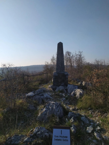
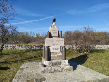
Here a monolithic obelisk made of karst stone marks the top of the mountain and provides an idealmene connection between the sites of the Great War: in fact, we can see from here the top of Mount San Michele, site of the Italian war museum, and the Cerje monument, a Slovenian memorial museum. Below our feet is a cold-war bunker of the arresting infantry, an element of first resistance of the Italian Army on the border: if the enemy had entered Friuli or the Isonzo plain, these units would have fought to the point of annihilation, to allow the troops of the second line (the armored and mechanized divisions) to deploy behind the Tagliamento.
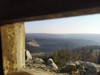
Our tour continues as we descend to the gun gallery, dug between January and August 1917 by the 3rd Company of the 5th Engineer Miners Regiment of the Royal Italian Army, and designed to house eight 149 mm cannons (divided into four segmants/pairs). Given the disastrous rout of Caporetto in October 1917 the work was never used for its intended purpose. Today it can be fully visited and is very impressive, a real museum.
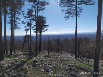
Coming out into the light again we descend into the valley and, leaving behind what is geologically the Monfalcone karst, we climb toward the Trieste karst. We turn halfway up and point toward getting to the Shrine of Our Lady of Sorrows of Merna, which we will not reach, and we immediately take the first downhill path by which we reach the attack of the second climb of the day, the macadam of Vrtoce, which will take us to the shoulders of Mount Volkovnjak. From this saddle we will be able to admire a magnificent panorama, that is, the Vipava and Soča valleys, where the peaks of Mount Calvary, the hill of Medea with the white shape of the Ara Pacis, and in the distance Mount Quarin of Cormons stand out:
We continue our ascent by taking a forest road on the left that heads toward the monument-museum of Cerje, then before we get there we will take a fast single track on the left, confusing Inter beaten earth and protruding stones.
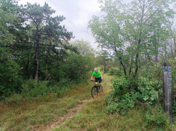
Having resumed the forest track we attack a small relief where at the top we find the remains of a mighty underground structure used by the Austro-Hungarians to hide a powerful searchlight that, by means of a system of rails and pulleys, was hoisted at night to ground level to illuminate the movements of Italian soldiers.
The more daring, descending from Pecina, will be able to walk down the trench to the throne of General Borojevic: Field Marshal Svetozar Borojevic was the only Slav (Croat) in the Habsburg Empire ever to have attained that rank. His successes on the Eastern Front in 1914 and on the Isonzo Front from 1915 onward made him the Habsburg Empire's most popular wartime military leader, but his legacy collapsed in 1918, along with the Empire to which he was completely devoted.
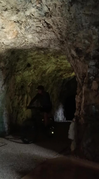
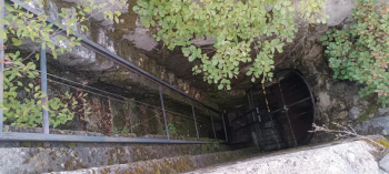
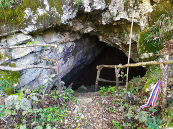
Continuing with a series of quick ups and downs, we will arrive at the Russians' cave, Ruska Jama: the small cave takes this name from the fact that during World War I the A-U army forced Russian soldiers prisoners of war from the Eastern Front there. They lived in pitiful conditions and were forced into hard labor in rear activities such as road construction, etc. For a short period (until the Battle of Caporetto) the cave was used by the Royal Army as an ammunition depot. Taking advantage of a good flashlight, the site is easy to visit, having no dangerous drops, holes or anything else on the ground, while the ceiling is never excessively low.
The entrance to the cave:
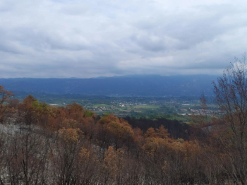
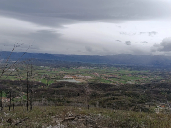
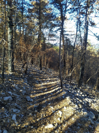
We now resume our trail by going up the short road that led us to the Ruska Jama, turn left and begin a series of steep climbs that will take us to the ridge of the karst plateau, where by turning left we will leave the forestry road and give the Faiti hump to climbing: the trail has a karst bottom that, combined with the slope, makes it a challenge to the last meter to reach the top of the relief, from which we can enjoy the panorama of the Vipava valley:
Fajti hrib, Faiti hump:
View from the Fajti hrib:
Here I recommend descending from the same path we came up, the path on the other side is hardly passable even on foot so I do not recommend it. Having resumed the forest road we now head towards Lateiner and the inscription praising the former president of Yugoslavia, Genaral Josip Broz Tito, and we are going to walk the Motopic Trail: the first part is a fairly fast descent, then the trail becomes very crunchy, hence its name.
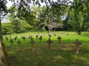
When we reach the village of Renski we will be forced to take a bit of asphalt, a secondary road with little traffic, which will get us to Bukovica, not before crossing the bridge over the placid Vipacco (Vipava) River. Having then left the small village we will take a dirt road, often muddy, overlooked by the Bukovica War Cemetery, where Russian soldiers who were prisoners of war of the Austro-Hungarian army rested. Now all that remains are crosses to remind us of this immense tragedy, the remains of the fallen in fact between the two wars have been moved to Russia, while the crosses have had their name plates removed.
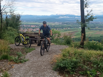
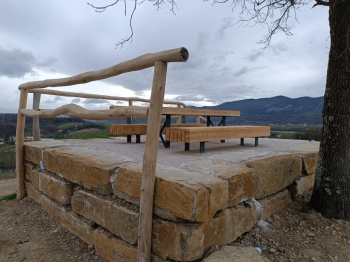
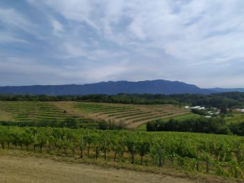
A steep climb among the vines, often stingy with grips, will take us to the top of Martinjak, where two benches and a table await us in the shade of an elm tree.
Although it is much lower than the peaks we touched on earlier, from here we can see cerje and its museum tower, the hill of Medea with the AraPacis, Mount Quarin, Mount Calvary, the church of St. Anrea and the castle of Gorizia. To crown it, higher up, the theater of the Julian Alps, Mount Sabotino, Sveta Gora.
A quick descent will bring us to the small village of Vertoiba and from there, via bike paths and fast dirt roads, back to Italy alongside the Guardia di Finanza barracks, and then via the state highway, a quick re-route to the starting point.


