
 Italiano
 Deutsch
Valle Brassamonti

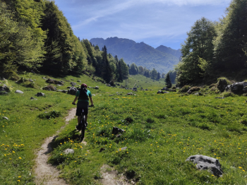
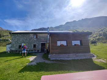
Emtb Cicloalpinistica version not extreme at the foot of Mt. Alben. Start from Cornalba, continue towards Serina and Valpiana on asphalt, then deviate on gravel road in places with 80 meters quite steep, continue to Pian della Palla and to follow on path not always rideable (in mtb) until the path that descends from Passo del Sappli. Bike on the shoulder and in 150 meters we are at the Pass from which we will continue on beautiful, mostly rideable trail to the Alben Refuge.
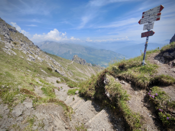
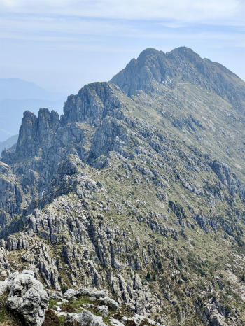
We climb about 250 meters by pushing to the Brassamonti Pass fork, the trail is not overly uncomfortable and by emtb we pedal a few sections. We leave the bike at the pass and continue on foot for about 150 meters to the summit of Cima della Croce (the trail has downhill rideability practically close to zero). The descent from the Brassamonti pass is for 400 meters an S4 with scree bottom and very difficult to ride nimbly, afterwards it becomes nice and easy in the woods in the last 150 meters. We continue on partly uphill roads (in the area of the water point facilities) and then on a slightly uphill strerrata road to Pian della Mussa . The tour continues on paths that are never too complex and very enjoyable to Serina and then to return to Cornalba.
Uphill variants:
By emtb it is more comfortable to climb from Cornalba by this trail.
Other variants
Ascent to Brassamonti Pass and Cima monte Croce peak
Descent variants:
Easy S2 descent from Sappli Pass this trail.
Bad and ill-advised technical descent S4 from Brassamonti Pass this track.
Technical descent S4 from up Cornalba this trail.
Trail Style: All mountain
Personal rating: views 8/10; descents 7/10
MTB: Yes
EMTB: Yes (Portage)
Duration about 5h (by mtb)
Portage: 250m
Difficulty ascent: challenging in mtb
Difficulty descent: 35% S4 remaining S1/S2
Exposed: Some section
Drainage: ND
Water points: Alben Refuge, former ski lift area
