Italiano
 Deutsch
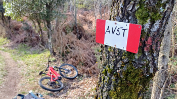
AV5T Alta Via delle 5 Terre in MTB
The crossing of the ridge overlooking the Cinque Terre, from Levanto to Portovenere with access by train.
Departure: La Spezia FS train station
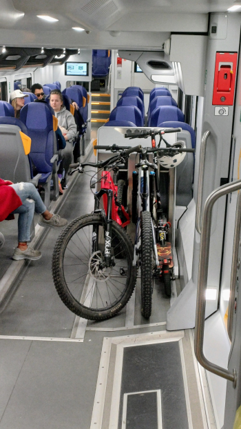
Access: train with bike transport La Spezia-Levanto (a sea-side seat is recommended to enjoy the breathtaking views between tunnels).
Once in Levanto, start pedaling uphill along Provincial Road 38 to Passo del Termine, where you intercept the Cinque Terre Alta Via trail.
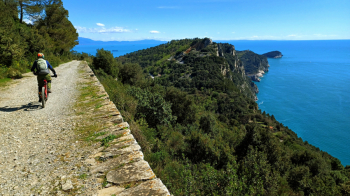
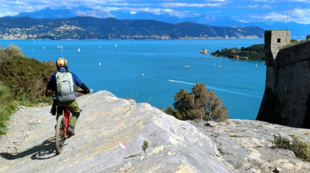
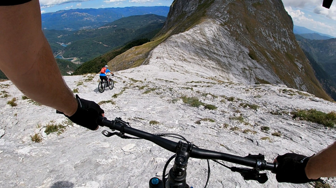
From here the fun begins: a long traverse with continuous ups and downs, always rideable. It alternates fast sections with more technical ones, without ever becoming really challenging. Trails always maintained in excellent condition by the Park Authority.
Extra tip: near Monte Cuna, it is worth making a short detour to Monte Le Croci so as not to miss an incredible view of the sea. Then continue to Telegraph Hill and the quaint village of Campiglia, where a stop to enjoy Ligurian focaccia on the sea-view terrace is a must. The route continues around Mount Castellana along the scenic Castellana Road until you reach the Sella dei Derbi.
From here, two descent options:
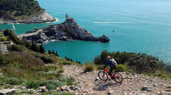
1) Hard: If you are willing to descend some sections on foot, especially if riding a heavy e-bike, follow our trail. The Infinity Trail offers spectacular views and leads directly to Portovenere Castle. It is technical and steep in places, but the view repays any effort.
2) Easy: you can safely descend along the paved, scenic road to Le Grazie, avoiding complications.
Recommended period: clear winter days. Route not recommended during the warmer months.
NB: On the route ALWAYS respect hikers, give them the right of way, wave, reduce speed or even get off the bike in the case of groups. Let's avoid the Park banning this trail for bikes, which has already been done for other trails closer to the sea. Do not drift, do not cut corners.