Italiano
 Deutsch
Foresta del Teso

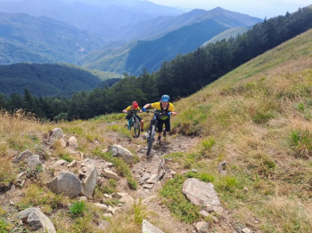
We start from the square of Lizzano in Belvedere (610 meters) and descend on the provincial road toward Silla to the junction for Pianaccio-Monte Acuto; we continue on the asphalt road passing first through Pianaccio and arriving at the Segavecchia refuge (930 meters). We leave the asphalt road by following the forest road to Bocca del Lupo (1482 meters) where we meet CAI 111 trail, a single track that takes us to the junction for the Porta Franca refuge and, continuing, we arrive at the Nevaia pass (1617 meters) on the CAI 00 Apennine watershed that goes up the ridge of Poggio dei Malandrini. Arriving at an important crossroads, we leave trail No. 00, which bends right to continue straight on towards the Rifugio del Montanaro (1567meters) and Rombicciaio crossing the Teso Forest.
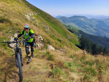
We continue downhill until we reach Orsigna (795 meters), place of the heart of journalist and writer Tiziano Terzani, where we stop for lunch. From here we go uphill along the asphalt road, continuing on the forest road that leads up to porta to Piano Selvano from where CAI path 35 starts and climbs to Rifugio Porta Franca; we take the CAI 101 path up to Rombicciaio (1395 meters) then left on the CAI 143 path that takes us to the Donna Morta pass (1368 meters) ; we continue on this fantastic path that from here becomes CAI 111, we pass La Caffa and arrive at Monteacuto delle Alpi (915 meters) crossing an enchanting chestnut grove. From here we take the paved road back to Lizzano in Belvedere.