
 Italiano
 Deutsch
2025/01/06 08:45:12
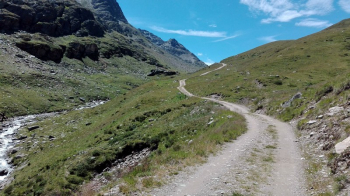
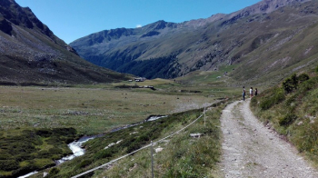
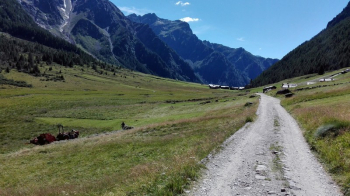
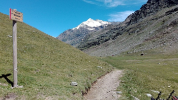
Val di Rezzalo
Author

Place
Italy - Lombardia, SO
Km
58,08 km
Elapsed time
08:40:06
Vertical meters
+1 800 mt (979 - 2472)
Route difficulty
Landscapes
Last update
2025/01/06 08:58:15
Comments
Description
Feasible route in both directions. You cross the spectacular Rezzalo Valley, which connects the Gavia Pass road with the Valtellina. Few singletrack sections, but precisely great alpine environment. Busy sections are avoided thanks to the Valtellina and Valtellina bike paths leading to (almost) Santa Caterina. The climb to Passo dell'Alpe, in either direction, is on trail that requires good leg; there may be some pushing sections depending on physical condition if climbing from Le Prese.
Local weather

°C
°C
°C
°C
°C
°C
Graph
Nearest Routes
51,88 km
Km
+3 385 mt
Vertical meters
Route difficulty
Landscapes
38,83 km
Km
+1 200 mt
Vertical meters
Route difficulty
Landscapes
61,88 km
Km
+2 851 mt
Vertical meters
Route difficulty
Landscapes
18,25 km
Km
+1 200 mt
Vertical meters
Route difficulty
Landscapes
24,33 km
Km
+339 mt
Vertical meters
Route difficulty
Landscapes
26,05 km
Km
+301 mt
Vertical meters
Route difficulty
Landscapes
47,94 km
Km
+987 mt
Vertical meters
Route difficulty
Landscapes
45,60 km
Km
+1 500 mt
Vertical meters
Route difficulty
Landscapes
26,76 km
Km
+1 500 mt
Vertical meters
Route difficulty
Landscapes
2023/09/15
- Italy - Trentino-Alto Adige/Südtirol, BZ 157,61 km
Km
+4 520 mt
Vertical meters
Route difficulty
Landscapes