HOME RANKINGS CHALLENGES ROUTES NEAR ME PLANNING SEARCH LOGIN
Austria
2025/01/04 09:55:01

Karwendelrunde mit dem MTB

1 Downloads
0
 
Share
Author
marco
(148)
Place
Austria
Km
66,82 km
Elapsed time
00:00:00
Vertical meters
+1 830 mt (890 - 1818)
Route difficulty
Landscapes
Last update
2025/01/04 09:57:47
Comments
0
Description

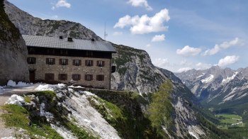
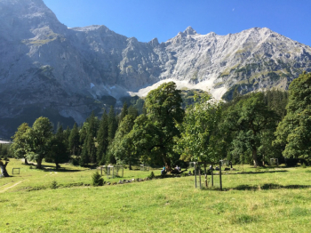
The classic Karwendel mountain bike tour starts at Scharnitz train station (alternatively: parking in Scharnitz at the nature park information center): Turn off at the church towards the Karwendel valleys, past the nature park information center and into the Karwendel valley, always along the Karwendelbach stream to the Hochalmsattel saddle not far from the Karwendelhaus. From the saddle, the route descends via numerous hairpin bends to the Kleiner Ahornboden. Via the Johannestal valley you reach Hinterriß, the only permanent settlement in the Karwendel.

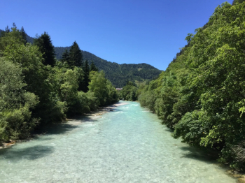
After a short flat section, the next ascent to Vorderbachsau and a stream crossing follow (please note: the Fermersbach can carry a lot of water in spring and after heavy rainfall!) Then there is a final steep section to the Fereinalm. Here you can stop for a bite to eat. The forest road from the alp continues leisurely to Mittenwald and via the Riedboden you can then complete the circle at the starting point of the tour in Scharnitz.

Download our free mobile app to send this route to your Garmin device or to navigate it on OSM maps. Android - iOS
Local weather
°C
°C
°C
°C
°C
°C
°C
°C
°C
°C

Graph

Nearest Routes

2025/01/04
- Germany
marco
(148)
53,96 km
Km
+1 500 mt
Vertical meters
Route difficulty
Landscapes
2025/01/04
- Austria
Staff
(89)
75,22 km
Km
+1 807 mt
Vertical meters
Route difficulty
Landscapes
2023/02/26
- Italy - Trentino-Alto Adige/Südtirol, BZ
nonnocarb
(294)
38,82 km
Km
+1 320 mt
Vertical meters
Route difficulty
Landscapes
2022/10/16
- Austria
17,66 km
Km
+850 mt
Vertical meters
Route difficulty
Landscapes
2022/10/02
- Austria
28,05 km
Km
+1 355 mt
Vertical meters
Route difficulty
Landscapes
2022/10/29
- Austria
31,87 km
Km
+1 482 mt
Vertical meters
Route difficulty
Landscapes
2023/03/05
- Italy - Trentino-Alto Adige/Südtirol, BZ
nonnocarb
(294)
36,54 km
Km
+2 270 mt
Vertical meters
Route difficulty
Landscapes

0 Comments