
 Italiano
 Deutsch
2024/11/16 07:42:14
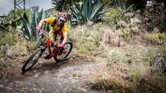
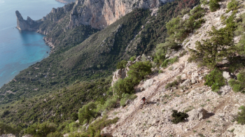
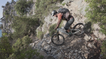
Cengia Giradili
Author
Place
Italy - Sardegna, NU
Km
16,10 km
Elapsed time
02:52:33
Vertical meters
+850 mt (-1 - 697)
Route difficulty
Landscapes
Last update
2024/11/16 08:19:55
Comments
Description
Short ibex-only route Starting from Pedra Longa and going up to the Supramonte plateau to go on the trail that skirts Punta Giradili and then swoops down to the sea I assume one of the most scenic and exposed trails in this area but very technical from start to finish made even more difficult by the very bumpy bottom.
Local weather

°C
°C
°C
°C
°C
°C
Graph
Nearest Routes
57,98 km
Km
+1 466 mt
Vertical meters
Route difficulty
Landscapes
32,76 km
Km
+900 mt
Vertical meters
Route difficulty
Landscapes
52,35 km
Km
+1 247 mt
Vertical meters
Route difficulty
Landscapes
28,81 km
Km
+900 mt
Vertical meters
Route difficulty
Landscapes
39,29 km
Km
+1 566 mt
Vertical meters
Route difficulty
Landscapes
63,41 km
Km
+1 374 mt
Vertical meters
Route difficulty
Landscapes
60,98 km
Km
+1 550 mt
Vertical meters
Route difficulty
Landscapes
56,29 km
Km
+1 100 mt
Vertical meters
Route difficulty
Landscapes
59,05 km
Km
+1 350 mt
Vertical meters
Route difficulty
Landscapes