Piandanazzo Ebike
Ascent designed for #ebikes, most of it on partly technical and steep trail.
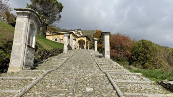
Start in Tesserete (paid parking available at the sports field) and follow the paved road towards Corticiasca. In Bidogno you pass through the middle of the village and then up the Via Crucis, at the end of which an uphill trail begins, easy except for a bend to the right that you will probably push through.

You pass 2 houses and then come out on the paved road, which you follow to the right for a few hundred meters. At an elevation of 950 meters you turn left onto a steep mule track that leads to a house, before becoming a trail with a couple of sharp, steep bends, as well as some technical steps uphill. Apart from two steps, one of which is at the end, and perhaps a hairpin turn to the right, the rest is done all in the saddle. This brings you to a fountain and a dirt road that you follow to the right on a false level for a few kilometers before taking another path to the left, the one that will take you to Piandanazzo.

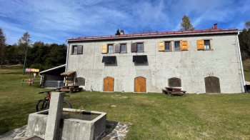
This too can all be done in the saddle, premised on a fair amount of technique particularly at a point with a rock step followed by lots of roots (satisfying when you close without putting your foot down). We then arrived at Piandanazzo, where there is a nice fountain and tables to enjoy the view before continuing uphill on trail, easy this time, to the highest point of the ride.

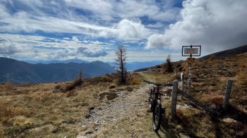
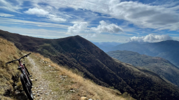
From here the first part of the descent into a spectacular valley begins: flowing and with a partly grassy bottom, it takes us to a house inhabited only in summer. From here a poisonous ramp requires you to dose your assistance well before setting off on a very long traverse with lots of up and down in a fabulous setting. We arrive at a farmstead where a steep little climb begins, followed by a flat section and finally the last ramp to the start of the endless descent.

This one is very rocky but easy until Davrosio, from where it becomes a bit more technical but still full of loose stones, and then arrives in the woods where it becomes more pleasant, with several ups and downs and never steep. The final part before reaching the road, with its many steps/steeps, will make you end the ride nice and content.


 Italiano
 Deutsch