HOME RANKINGS CHALLENGES ROUTES NEAR ME PLANNING SEARCH LOGIN
Italy - Toscana, FI
2024/09/05 19:44:33

Anello Acquacheta

1 Downloads
0
 
Share
Author
Nikfab
(14)
Place
Italy - Toscana, FI
Km
41,45 km
Elapsed time
06:37:38
Vertical meters
+1 800 mt (470 - 1133)
Route difficulty
Landscapes
Last update
2024/09/06 09:06:44
Comments
0
Description

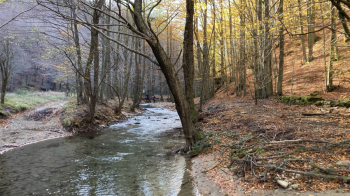
Beautiful trail with departure just before arriving at Passo del Muraglione on the left is a nice dirt road , where there are also signs for the Acquacheta Waterfall. From here it is about 8 km before arriving at the Fosso Acquacheta that will have to be forded about 5 or 6 times, the water is not very high but in this period we inevitably got our feet wet so take this into account.

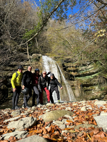
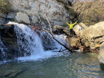
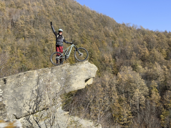
Arriving at Piano dei Romiti we make a detour to the famous Dante's Bed for the customary photos and then to the waterfall from above and then continuing on to the little terrace placed in front of the Waterfall. Past this point you go up a nice single track that is quite steep in places until you get near Case Baruzzoli from where there is a splendid view. From here there is a wide dirt road that takes us up to the highest point, Colle di Tramazzo, and from here with a splendid single track in some points quite exposed we descend to the village of San Benedetto in Alpe.

Stop at the Campeggio restaurant for a good tortello and start again for the Monte Gemelli forest road that takes us back to the opposite ridge up to Monte Mazzuca and then from here continues on a beautiful single track in the beech forest almost to Muraglione, the last stretch is halfway up the hill with a very narrow track.


?
Download our free mobile app to send this route to your Garmin device or to navigate it on OSM maps. Android - iOS
Local weather
Today
4 °C
Tonight
-3 °C
Tomorrow
5 °C
Tomorrow night
-3 °C
Monday
3 °C
Monday night
-2 °C
Tuesday
5 °C
Tuesday night
-2 °C
Wednesday
4 °C
Wednesday night
-2 °C

Graph

Nearest Routes

2023/03/01
- Italy - Toscana, FI
Nikfab
(14)
42,20 km
Km
+1 825 mt
Vertical meters
Route difficulty
Landscapes
52,60 km
Km
+2 435 mt
Vertical meters
Route difficulty
Landscapes
2023/09/15
- Italy - Emilia-Romagna, FC
FiloPado
(3)
24,47 km
Km
+1 060 mt
Vertical meters
Route difficulty
Landscapes
2023/07/29
- Italy - Emilia-Romagna, FC
kcolrah
(3)
39,84 km
Km
+1 334 mt
Vertical meters
Route difficulty
Landscapes
2023/05/25
- Italy - Emilia-Romagna, FC
bonfi62
(11)
30,94 km
Km
+1 270 mt
Vertical meters
Route difficulty
Landscapes
2023/11/11
- Italy - Emilia-Romagna, FC
Paoloc1
(66)
41,30 km
Km
+1 600 mt
Vertical meters
Route difficulty
Landscapes
2023/05/25
- Italy - Emilia-Romagna, FC
bonfi62
(11)
37,14 km
Km
+1 630 mt
Vertical meters
Route difficulty
Landscapes
2024/01/28
- Italy - Toscana, FI
ebsat
(109)
38,02 km
Km
+1 552 mt
Vertical meters
Route difficulty
Landscapes
2024/05/19
- Italy - Toscana, FI
ebsat
(109)
38,75 km
Km
+1 384 mt
Vertical meters
Route difficulty
Landscapes
2023/06/20
- Italy - Emilia-Romagna, FC
50,96 km
Km
+2 000 mt
Vertical meters
Route difficulty
Landscapes

0 Comments