HOME RANKINGS CHALLENGES ROUTES POI PLANNING SEARCH LOGIN
Italy - Valle d'Aosta, AO
2024/08/30 20:10:59

Gressoney - Colle di Bettaforca - giro ad anello antiorario

0 Downloads
0
 
Share
Author
gmzolenart
(115)
Place
Italy - Valle d'Aosta, AO
Km
16,70 km
Elapsed time
04:28:45
Vertical meters
+1 050 mt (1639 - 2680)
Route difficulty
Landscapes
Last update
2024/08/30 21:03:55
Comments
0
Description

Classic route from Staffal to Colle done in 2009. Today accomplice the parking situation in Staffal, I leave at 8 a.m. from Gressoney La Trinitè on asphalt to Staffal, the 4 and a half kilometers with 200 meters of elevation gain take more than 20 minutes. The steep climb begins with a sandy bottom accomplice to the passage of off-road vehicles and vans. The most rideable part begins on a traverse and continues from the lifts - Betta Station - to the last lift station; here a long, steep climb leads up to plateau within sight of the Bettaforca Pass. The climb overall requires 2 to 2 1/2 hours of considerable physical effort.

Several downhill skiers use the lifts; today there was an unfortunate one, he broke his dropout just as he started the descent, had to relay the gear and ride down to Gressoney Saint Jean without pedaling. In common with me he had the idea of descending from trail 9, passing in the vicinity of the Oratory of Sant'Anna, to arrive directly on Gressoney La Trinitè. It is a trail in the first trialistic part, quite smooth in the intermediate part with trees, finally joining with wide dirt road leading to the village without touching an inch of asphalt.

Departure from Gressoney La Trinitè, free parking.
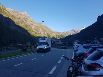
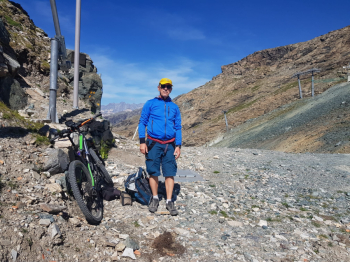
First section, where it flattens out and you can take 2 photos
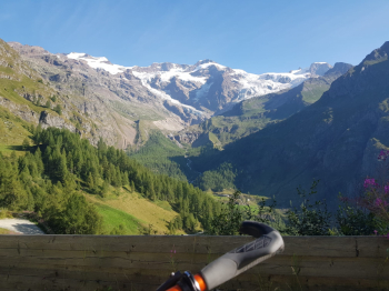
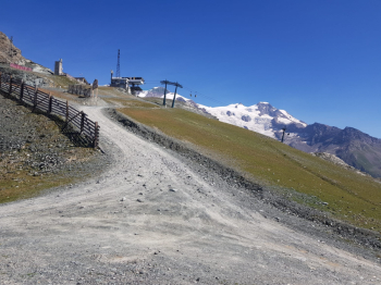
The glacier at the end of August
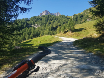
Last stretch of ascent
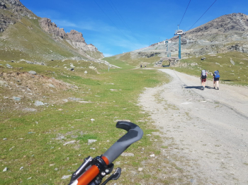
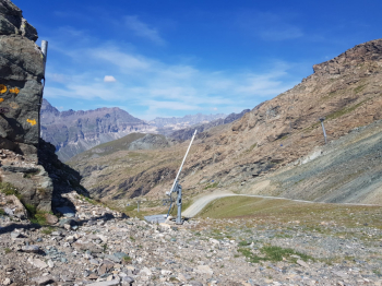
Descend to the right on trail 9 and Oratorio di Sant'Anna
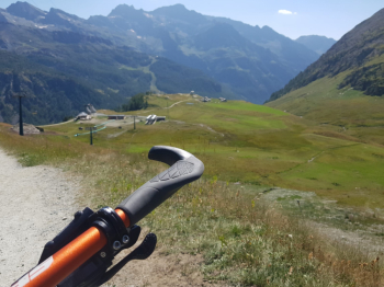

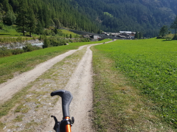
Last stretch of dirt road to get to Gressoney La Trinitè


Download our free mobile app to send this route to your Garmin device or to navigate it on OSM maps. Android - iOS
Local weather
°C
°C
°C
°C
°C
°C
°C
°C
°C
°C

Graph

Nearest Routes

2022/09/21
- Italy - Valle d'Aosta, AO
yura
(8)
18,02 km
Km
+1 780 mt
Vertical meters
Route difficulty
Landscapes
2023/06/23
- Italy - Valle d'Aosta, AO
yura
(8)
32,97 km
Km
+1 613 mt
Vertical meters
Route difficulty
Landscapes
2023/08/31
- Italy - Valle d'Aosta, AO
Dadobo
(1)
72,44 km
Km
+2 200 mt
Vertical meters
Route difficulty
Landscapes
2023/07/24
- Italy - Valle d'Aosta, AO
yura
(8)
37,32 km
Km
+1 850 mt
Vertical meters
Route difficulty
Landscapes
2022/10/02
- Italy - Valle d'Aosta, AO
BAROLO71
(34)
14,78 km
Km
+1 000 mt
Vertical meters
Route difficulty
Landscapes
2023/06/28
- Italy - Valle d'Aosta, AO
yura
(8)
27,23 km
Km
+1 889 mt
Vertical meters
Route difficulty
Landscapes
2022/11/07
- Italy - Valle d'Aosta, AO
paiogs
(12)
25,85 km
Km
+2 100 mt
Vertical meters
Route difficulty
Landscapes
2022/08/22
- Italy - Valle d'Aosta, AO
nonnocarb
(292)
17,25 km
Km
+700 mt
Vertical meters
Route difficulty
Landscapes
2022/08/22
- Italy - Valle d'Aosta, AO
nonnocarb
(292)
19,82 km
Km
+989 mt
Vertical meters
Route difficulty
Landscapes
2022/08/22
- Italy - Valle d'Aosta, AO
nonnocarb
(292)
22,30 km
Km
+468 mt
Vertical meters
Route difficulty
Landscapes

0 Comments