MTB 3 La Gotica
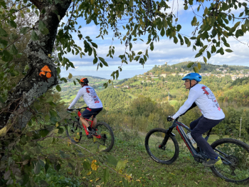
MTB 3 La Gotica is a route with scenic climbs that will make your ride even more exciting. On the traces of the trenches left over from World War II, you will touch the village of Maserno, the highest point of the territory at Monte Belvedere and other hidden corners among woods and trails.

Just outside Montese you find the short descent of the Coste that leads to the Treppi della Ruzzola. Then go up an ancient road in some places still paved. At the Agriturismo il Palazzino leave the short asphalt road and climb to the right a small road with a view of the village. It becomes a path, descending into the woods overlooking the Striscialacqua waterfall and the Fredda beech biotope. With a double right turn it crosses the stream, climbing up to the village of Maserno where there are refreshments and a fountain.
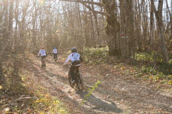
From the center climb up to near the ruins of Monteforte Castle, just before which you turn right onto a fun cavedania composed of ups and downs that then opens into fields to climb back to the Alberelli fountain and the hamlet of Forni. Between two houses take a path to the right, more ups and downs in a mixed environment of woods and fields and small wetlands. When you reach the asphalt road go up again greeted by several specimens of ancient chestnut trees until you reach the village of Malalbergo.
NB: Here you can shorten the route with a double left turn at the top of the climb, soon finding the La Gotica signs again.

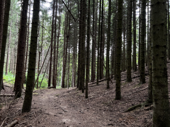
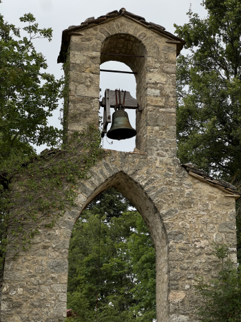
Continuing after a stretch in the woods you arrive at Via Pianello, slowly begin to climb by dirt road with first an open panorama and then a wide cart track in the woods until you meet the Ronchidoso dirt road, which you descend to the right, then climb back up to SP66. Shortly after past the provincial boundary sign leave the paved road for the determined climb to Monte Belvedere on CAI 400/4, which, with the right effort, gives splendid views from the highest point in the area at 1138 m. Enjoy the flow on a forest road until you catch a glimpse of the church of Ronchidoso to enter the forest and pass at its foot among the broadleaf trees on a playful downhill trail, before climbing back into the fir forest and taking a technical downhill single track back to the ridge.

From there you descend into Malalbergo among ancient chestnut trees and continue until you come out onto fields and then a short stretch of asphalt. This leads back to the slightly downhill trail to Monteforte, along a shady stream. From Monteforte go up a few hundred meters with a firm but short climb on a stony surface and at the edge of a field, turn left for one of the most beautiful downhill slopes in the entire area. Try it to believe! Also take a look at the sinkholes, fascinating formations that surround the sides of the trail.
Once the descent is over, take the asphalt road (water point in the square in Maserno) and soon turn right onto cart track following CAI 422a, then watch out for the left turn into the grove that leads onto field edges leading to the Oratorio dei Bicocchi where you find the asphalt again. One last stretch takes a left before the entrance to Montese, parallel to route No. 1 School, which refreshments before the final asphalt climb back to the square.

MTB 3 La Gotica is one of many mountain bike trails in collaboration between 841 RIDE Wild and the Municipality of Montese, which with varying levels of difficulty, elevation gain and length, according to IMBA's ITRS signage, take you to discover an area perfect for your dowels.


 Italiano
 Deutsch