Monte Caucaso da Gattorna
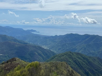
This itinerary starts in Gattorna, follow the asphalt road in the direction of Moconesi, continue uphill in the direction of San Rocco, beginning the dirt road. At the crossroads, you leave the signs for San Rocco and follow to the right, still uphill. You come to a clearing with benches, where the dirt road gives way to a flat single track that comes out on the Scoglina pass road, where you take a left to tackle the last mile and a half on asphalt before reaching the pass. Here you turn left and on asphalt continue uphill toward Barbagelata. Before arriving at the village turn left on dirt road toward Mount Caucasus, after a short while you will find a spring on the right. On reaching the top of Mount Caucasus you will find therefuge of the same name for a well-deserved rest. On fine days the view passes from Portofino to Sestri Levante, with the possibility of glimpsing Gorgona Island and in exceptional cases even Corsica.

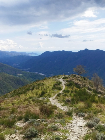
To take the descent path you retrace your steps slightly to take the fantastic path to the left that follows the entire ridge to Pietra Cavallina. Just before arriving at Pietra Cavallina you take a left towards the Croci pass, upon reaching which this trail continues straight on the ridge, there is the possibility of descending to the left and then rejoining the trail afterwards. On the ridge trail the views remain stupendous.

This brings you to San Rocco and its giant bench, where you take a right and after a short climb up a dirt road you take the Rueiu trail to the left, after an initial flat section you descend to the left and the story changes, very steep trail with a bumpy bottom. When you arrive on dirt road you take a right and after the house you descend left on path, you arrive on asphalt and after a few turns you return to Gattorna.


 Italiano
 Deutsch