Italiano
 Deutsch
Cima Sospiri + Monte Bestone Extreme
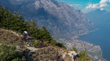
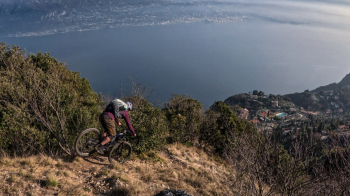
Very scenic tour above Lake Garda but extremely technical especially for the last part of the descent on the Butterfly Trail. Departure from Limone, climb on asphalt until Vesio, then in the direction of Nota Pass continue on beautiful and scenic military road. The last stretch to the top of Punta Selva/Cima dei Sospiri is very steep and alternates between pedaled and pushed sections. From Cima dei Sospiri begins our first part of the descent to Bestone. Initially on a fairly flowing trail but full of switchbacks often to be done in nose press, then on a more guided trail but with a more rocky and technical bottom.
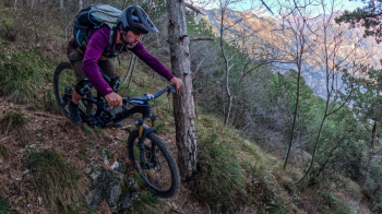
Once the descent is over, a short, steep climb awaits us to climb to the top of Mt. Bestone. From here the view is spatial and from here our adventurous descent back to Limone will begin. The idea was to tackle the Butterfly Trail but the whole first part is very uneven and very un-bikeable given that it has numerous equipped pieces, so I decide to try an alternative. I start descending along the south ridge of Bestone that alternates steep and technical sections with flowing and super scenic sections. Arriving at Balze locality I take a traverse that, mostly downhill and with a few uphill climbs, reconnects me to the lower part of the Farfalle trail, making me avoid the entire upper part unsuitable for Mtb. Unfortunately the traverse is left a bit to itself and due to the vegetation in some places is not cyclable (I would say a 60-40), however it passes quickly. The final part of the Butterfly trail is extremely technical with the classic Garda bottom that limits a lot the grip of the tires and makes it even more difficult, however except for a couple of points and provided you have a good technique, it turns out to be cyclable.
In the end it turned out to be a great ride with a mix of situations that will satisfy lovers of the genre. The technical difficulty of the descent, except for a couple of S4/S5 passages that I didn't do, I don't think it goes beyond an S3, the problem being the exposure that is high in some sections and the bottom that makes everything very slippery and unstable. A trivial hairpin bend that we would have no problem closing, in this particular context will give us a lot of trouble.
NB:
- Suitable only for experienced bikers
- Do not go in too dry periods or in summer (the trail may close more from the vegetation)
- Mount good tires!