2024/02/15 12:04:15
Val di Cembra Trail Area
Author
Place
Italy - Trentino-Alto Adige/Südtirol, TN
Km
21,53 km
Elapsed time
05:53:39
Vertical meters
+1 150 mt (768 - 1493)
Route difficulty
Landscapes
Last update
2024/02/15 18:26:12
Comments
Description
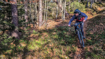
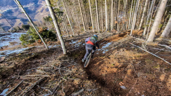
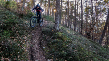
Nice enduro ride in the area between the Cembra Valley and the Pinè Lakes. In the trail you will find 3 of the 11 trails that are part of this Trail Area. All are well marked and easily accessible. The trails are mostly inside the forest, they all have a nice dirt surface and are very smooth where you can speed, some technical sections are there, but nothing extreme. Great place to have fun and then have a drink by the lake.
Given the starting elevations of the trails (the highest ones start at 1450 meters) and their northwest exposure I do not recommend going in the winter time at least if you don't like driving on snow and ice.


Local weather
Today

22 °C
Tonight

11 °C
Tomorrow

22 °C
Tomorrow night

13 °C
Tuesday

18 °C
Tuesday night

10 °C
Graph
Nearest Routes
17,79 km
Km
+929 mt
Vertical meters
Route difficulty
Landscapes
2023/07/06
- Italy - Trentino-Alto Adige/Südtirol, TN 26,58 km
Km
+600 mt
Vertical meters
Route difficulty
Landscapes
7,40 km
Km
+267 mt
Vertical meters
Route difficulty
Landscapes
2025/01/27
- Italy - Trentino-Alto Adige/Südtirol, TN 32,35 km
Km
+1 482 mt
Vertical meters
Route difficulty
Landscapes
3,70 km
Km
0 mt
Vertical meters
Route difficulty
Landscapes
28,26 km
Km
+1 600 mt
Vertical meters
Route difficulty
Landscapes
19,93 km
Km
+1 100 mt
Vertical meters
Route difficulty
Landscapes
34,31 km
Km
+1 100 mt
Vertical meters
Route difficulty
Landscapes
21,38 km
Km
+911 mt
Vertical meters
Route difficulty
Landscapes
36,90 km
Km
+1 604 mt
Vertical meters
Route difficulty
Landscapes


 Italiano
 Deutsch