Italiano
 Deutsch
PietraPizzuta - Singletrack enduro mtb

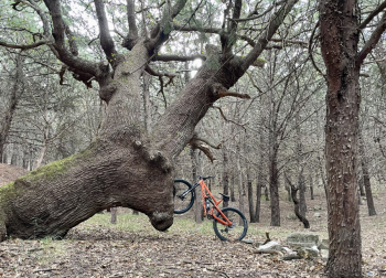
Fabulous tour that reaches the highest peak in the area, Mount Soprano, and then descends through an endless path of more than 450 meters of negative elevation gain. On sunny days there is an incredible 360-degree breathtaking panorama from the entire Gulf of Taranto to the Pollino National Park.
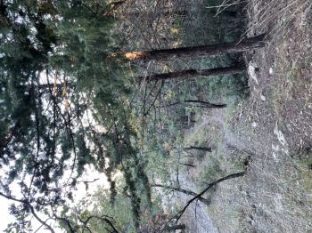
It starts from the convenient roadside parking lot on SP150 near the Canna stream bridge at the foot of the same hamlet. With a series of dirt roads, immersed in the dense pine forest that ensures an ideal climate for both summer and winter cycling, you almost reach the summit. The last 10 minutes, about 300 meters, are done by bike to reach the highest point at about 700 meters above sea level.
You descend the trail alternating between very challenging technical passages with gradients up to 30%, and others fast with jumps in sequence to then reach the starting parking lot. The descent requires good technical ability, bike in perfect condition and full-face helmet. The trail has no drinking water supply. In the area it is common to encounter native wildlife such as foxes, porcupines, wolves, wild boars, pine martens and squirrels.