
 Italiano
 Deutsch
2024/01/28 19:08:11
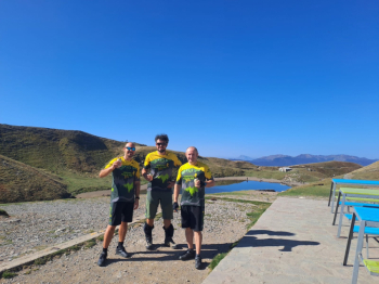
Passo dello Strofinatoio e passo del Cancellino
Author

Place
Italy - Emilia-Romagna, BO
Km
32,32 km
Elapsed time
04:28:32
Vertical meters
+1 340 mt (557 - 1848)
Route difficulty
Landscapes
Last update
2025/01/26 11:31:55
Comments
Description
We go up the provincial road until we reach Lake Cavone, short stretch on asphalt and after the tunnel that passes above the Tomba slope we find on the left the forest road (CAI 329) that, passing by Rifugio le Malghe (1640 a.s.l.) takes us to Lake Scaffaiolo (1775 a.s.l.).
We follow the ridge trail to the Strofinatoio Pass (1847 a.s.l.) and then descend to the Cancellino Pass (1630 a.s.l.).
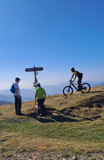
From here you prepare to tackle 700 meters of negative elevation gain through a single track (CAI 121) that alternates guided and fast sections with very technical and almost trial-like passages to the Segavecchia refuge. We follow the paved road that, passing through Pianaccio (Enzo Biagi's birthplace), takes us back toward Lizzano.
Local weather

°C
°C
°C
°C
°C
°C
Graph
Nearest Routes
2025/01/25
- Italy - Emilia-Romagna, BO 32,32 km
Km
+1 350 mt
Vertical meters
Route difficulty
Landscapes
30,53 km
Km
+1 700 mt
Vertical meters
Route difficulty
Landscapes
40,57 km
Km
+2 000 mt
Vertical meters
Route difficulty
Landscapes
40,15 km
Km
+1 370 mt
Vertical meters
Route difficulty
Landscapes
31,61 km
Km
+1 850 mt
Vertical meters
Route difficulty
Landscapes
50,11 km
Km
+2 010 mt
Vertical meters
Route difficulty
Landscapes
55,02 km
Km
+2 580 mt
Vertical meters
Route difficulty
Landscapes
2023/12/30
- Italy - Emilia-Romagna, BO 31,29 km
Km
+1 410 mt
Vertical meters
Route difficulty
Landscapes
52,92 km
Km
+2 100 mt
Vertical meters
Route difficulty
Landscapes
36,13 km
Km
+1 570 mt
Vertical meters
Route difficulty
Landscapes