Alpe Previano e Passo del Ranghetto via Alpe Cignerra
Late autumn, palette colors, gorgeous day and great scenery! From Varallo I climb up to Alpe Previano via Morondo. Once again I get lost among the ferns: to reach the road that leads to Due Faggi, it would be enough to descend just below the house and follow the small gully that runs flat, and then launch into the short climb that reaches the edge of the forest (incredible but rideable with eMTB).
From there I continue first on the flat and then with a descent to the Two Beeches: imposing, the masters of the woods! With a sharp turn, I take the road that I imagined was a path, and instead is a nice flat driveway that leads to Alpe Soliva: I catch a glimpse among the branches of the first sunlit farmhouse, and shortly after I am among the huts. The pasture is exactly below Alpe Sacchi, and the landscape over Lake Orta behind the sinuous row of golden plants is the same. I stop to photograph an ancient Madonna frescoed on a wall that is close to collapsing, at least there will be some evidence of it left - and I stop again, on the way out of what looks like a micro-paesino, for one last backlit shot.
Shortly afterwards I rejoin the Alpe Sacchi road and descending past the fork leading to the "Fò dl'Umbrela" (I've been there recently and shoot straight ahead, but it's worth a look), I turn left to discover shortly afterwards another woodland gem: the Alpe Cignerra looks like a plastic model, with neat little houses in the middle of a meadow that is still very green, contrasting with the bright yellow of the leaves lit up by the grazing sun. Beautiful!
Immediately after the chapel of Our Lady of Cignerra, the road becomes a miserable path: steep, rocky and full of roots. Exactly as I imagined it seeing it on the GPS map, so no surprises there. Some crazy biker would still launch himself jumping like a deer, but I prefer to walk it, given the results of the last fall, and besides it's only a few hundred meters. If I do it again I will walk the one that goes down to the right: it seems less bad.
At the end of the path, near the stream, a group of ruined, moss-covered buildings create a Harry Potter-like atmosphere; a small bridge overlooks a puddle where a multitude of tiny fish swim among the reflections; just beyond, the path climbs back up to join the road leading to Alpe Camasca after a long climb of switchbacks.
Work on the road is continuing: the bottom has been "rolled" and large stone slabs have been placed at the streams that will serve as fords.
Before setting off I was thinking about this section with some concern - I'm riding it uphill for the first time - but I must say that my Bosch set on Trail did not disappoint, and without too much effort I find myself at the Capella Alpina della Camasca. A brief stop for refreshments and off I go! I still imagined the climb up to Ranghetto to be longer and more strenuous, but it was actually a piece of cake.
I'm relatively new to the ebike world, and mindful of past jaunts, I marvel at each climb. Before the long descent to Varallo, via Camasco, I put on everything I can, and I do well: if at Ranghetto the sun still shines warmly despite the 1280 meters of altitude, the fast descent is almost completely in the shade, and when I get home I dive into my bath-sauna at 42*C without a second thought.
Nice ride, nice day and also a couple of new trails that excited me with their scenery, so I can't claim more.
In the list of my outings today I added a column for rating, and today's deserved 5 stars! I will definitely do it again, perhaps with the first green of spring.
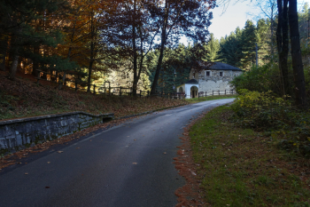
Going up past Camasco: Loc. Chiesa delle Pecore
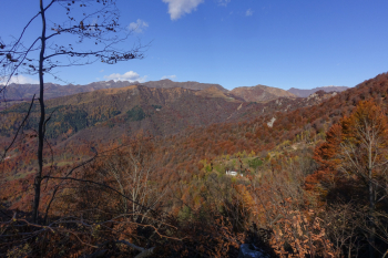
View of the Ranghetto Pass, which I will hike on the return trip. On the left is Monte Camossaro and in the background is Monte Capio

Alpe Previano. On the right the Mottarone
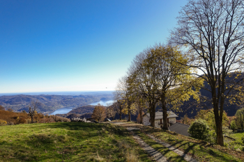
View of Lake Orta from Alpe Previano

Locality two Beeches
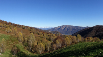
Panorama from Alpe Soliva
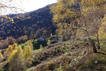
Alpe Soliva
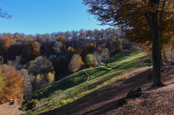
Alpe Cignerra
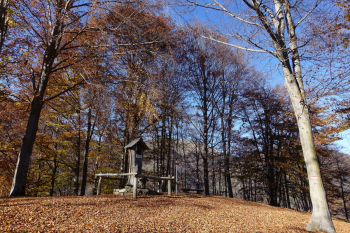
Just beyond the Chapel of Madonna di Cignerra the descent on roots begins

Moss-covered ruins before the long climb to Alpe Camasca
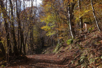
The "superhighway" to Alpe Camasca

The first houses of the "Camasca"
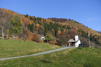
The Chapel of the Alpini at the entrance of Alpe Camasca

Panorama on the return route from the road to Ranghetto

Ranghetto Pass. Game over: we descend to Varallo...

...in a tunnel of colors


 Italiano
 Deutsch

