2022/09/25 20:34:41
Col Prial - Lys Valley
Author
Place
Italy - Valle d'Aosta, AO
Km
17,67 km
Elapsed time
06:19:15
Vertical meters
+1 367 mt (992 - 2334)
Route difficulty
Landscapes
Last update
2022/10/09 21:11:22
Comments
Description
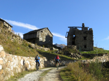
From Borney 1017 m climb up a nice dirt road to hamlet Prial Desot 1970 m and then portage to Col Prial 2329 m, highest point.
The descent trail is No. 1, in the section between Kiry Chapel or St. Peter in Bonds and Kiry, then between St. Mary Magdalene and Troumpoy. The trail cuts the dirt road and is very challenging, especially in the lower part, the wheels are constantly balancing on the stones. The 'southeastern exposure allows cycloexcursion from late June to November.
The Hiking Editor No. 12 - Lower Ayas and Lys Valleys - Trail map (1:25,000)


Local weather

°C

°C

°C

°C

°C

°C
Graph
Nearest Routes
21,23 km
Km
+930 mt
Vertical meters
Route difficulty
Landscapes
20,49 km
Km
+903 mt
Vertical meters
Route difficulty
Landscapes
24,87 km
Km
+1 231 mt
Vertical meters
Route difficulty
Landscapes
25,79 km
Km
+2 400 mt
Vertical meters
Route difficulty
Landscapes
25,85 km
Km
+2 100 mt
Vertical meters
Route difficulty
Landscapes
27,23 km
Km
+1 889 mt
Vertical meters
Route difficulty
Landscapes
14,78 km
Km
+1 000 mt
Vertical meters
Route difficulty
Landscapes
37,32 km
Km
+1 850 mt
Vertical meters
Route difficulty
Landscapes
72,44 km
Km
+2 200 mt
Vertical meters
Route difficulty
Landscapes
18,95 km
Km
+1 050 mt
Vertical meters
Route difficulty
Landscapes


 Italiano
 Deutsch