HOME RANKINGS CHALLENGES ROUTES POI PLANNING SEARCH LOGIN
Italy - Trentino-Alto Adige/Südtirol, TN
2022/09/24 22:10:19

Carega, Lessinia

46 Downloads
3
 
Share
Author
nikogaz
(11)
Place
Italy - Trentino-Alto Adige/Südtirol, TN
Km
48,51 km
Elapsed time
07:57:50
Vertical meters
+2 622 mt (172 - 2169)
Route difficulty
Landscapes
Last update
2022/09/24 22:37:45
Comments
2
Description

Premise to bring a good supply of water because until the Fraccaroli refuge you will not find any.

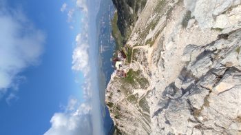
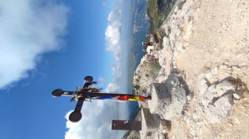
Free and ample parking in Via Fornace in Ala. We climb towards Val di Gatto with first asphalt part and then dirt road but with good fund arrived at the hut you will be able to (rest) pushing the bike until the Pra Bel pass (1640m). From there continue on a path that will be hard to face but the efforts will be repaid by the views that will leave you speechless. You will pass under the Cima Levante then skirt the Pala di Cherle and arrive up to the Sinel Hut (1990m). You will pass Bocchetta della Neve and always pedaling you will reach the final ramp that leads to Rif. Fraccaroli (2238m) located just below Cima Carega that you will reach in a short climb. Now first descent, be careful that it will be hard with very technical sections on the bottom at first loose then with roots with some steps to be done on foot, arrived at the refuge passo pertica you will have to take the path right next to it that goes up to passo malera with first and last stretch that will force us to push-shoulder, arrived at the pass you reach San Giorgio from there last efforts on dirt road with constant climb that will lead you to the Castelberto refuge where you can rest to face the last trail 111 will also be challenging but you will arrive at the cars with a smile.

Challenging route both uphill but especially downhill suitable for MTB All mountain or enduro that passes on prohibited trails, always give precedence to pedestrians.
Download our free mobile app to send this route to your Garmin device or to navigate it on OSM maps. Android - iOS
Local weather
°C
°C
°C
°C
°C
°C
°C
°C
°C
°C

Graph

Nearest Routes

2023/09/03
- Italy - Trentino-Alto Adige/Südtirol, TN
richin
(5)
35,97 km
Km
0 mt
Vertical meters
Route difficulty
Landscapes
2023/06/18
- Italy - Trentino-Alto Adige/Südtirol, TN
nikogaz
(11)
41,35 km
Km
+1 959 mt
Vertical meters
Route difficulty
Landscapes
2024/07/22
- Italy - Trentino-Alto Adige/Südtirol, TN
Staff
(77)
31,38 km
Km
+1 648 mt
Vertical meters
Route difficulty
Landscapes
2023/03/04
- Italy - Trentino-Alto Adige/Südtirol, TN
nikogaz
(11)
29,16 km
Km
+1 524 mt
Vertical meters
Route difficulty
Landscapes
2023/05/19
- Italy - Trentino-Alto Adige/Südtirol, TN
37,21 km
Km
+1 900 mt
Vertical meters
Route difficulty
Landscapes
2022/10/02
- Italy - Trentino-Alto Adige/Südtirol
47,30 km
Km
+1 972 mt
Vertical meters
Route difficulty
Landscapes
2023/12/21
- Italy - Trentino-Alto Adige/Südtirol, TN
32,04 km
Km
+1 700 mt
Vertical meters
Route difficulty
Landscapes
2023/09/04
- Italy - Veneto, VR
rfranz
(30)
24,10 km
Km
+750 mt
Vertical meters
Route difficulty
Landscapes
2024/01/03
- Italy - Trentino-Alto Adige/Südtirol, TN
36,63 km
Km
+1 848 mt
Vertical meters
Route difficulty
Landscapes
2022/11/14
- Italy - Trentino-Alto Adige/Südtirol, TN
steve-U
(23)
36,71 km
Km
+1 495 mt
Vertical meters
Route difficulty
Landscapes

2 Comments