Italiano
 Deutsch
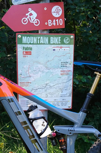
Tirano - Trivigno - monte Padrio - Piangembro - Stazzona
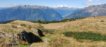
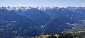
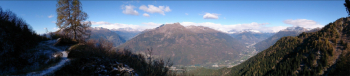
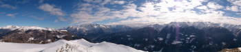
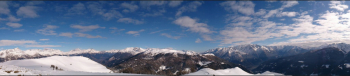
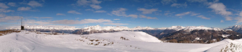
The trail retraces the most beautiful and exciting stretches of the "Padrio Grazi Down" descent by extending and linking it with other trails. Starting from Tirano at 430 meters, it climbs the paved road for 16 km to the Trivigno junction at 1600 meters. From here the trail becomes unpaved, climbs to the small church and goes around Mount Giovello and the plain of Trivigno Alta at 1800 meters. It climbs to the summit of Mt. Padrio at 2153 meters with a few short steep sections to push. From the summit there is a 360-degree view of Valtellina, ranging from Mount Disgrazia, Bernina, Cima Piazzi, Stelvio Ortles, Adamello, and Pizzo Coca. From the summit you retrace your descent to 1900 meters ( the start of the "Padrio Grazi Down") where the trail plunges into the pine forest descending along the ridge to the 1350-meter Mount della Croce at Pian Gembro. If desired, one continues by making a wide loop around the plain immersed in the pine forest and ponds to the west parking lot. From here at 1350 meters the long descent on mule track resumes until we reach Mezzomonte at 1100 meters, then by nice dirt roads (never trivial) continues to Stazzona at 400 meters where the bike path or road l'ungo the Adda River takes us back to Tirano.
The Trail is very long and challenging, possibility to reduce it by avoiding the Piangembro loop. Very nice also with DH/Enduro bikes, leaving the car in Trivigno high at 1850meters, climb up to 2150 and then make all in one go the descent to Stazzona (1800 meters of elevation gain ) with small uphill/downhill sections. Alternatively by walking the original section of the "Padrio Grazi Down".