Sentiero 00 Monti Pisani
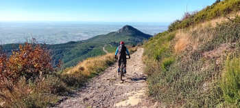
Nice ride in the Monti Pisani, great both for discovering the entire ridge from the Santallago Estate to San Giovanni alla Vena and as a real workout. In fact, this ride includes everything you need: long climbs, descents on galliard trails, fast rocky descents, beautiful views, a mostly rocky bottom (allowing you to ride it even in rainy periods, always ensuring a good grip without causing damage to the trails) and the certainty of always meeting other bikers. Finally, there is no shortage of a few miles of flat terrain, always useful for doing some cross-country riding.
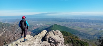
Starting from the station in Lucca, you take the path along the Nottolini aqueduct, reach Vorno via the "Vorno villas path," and from there begin the climb through the woods to Santallago. From here on you follow (more or less faithfully) the CAI 00 trail passing by Monte Serra, Passo di Prato a Giovo, Sasso della Dolorosa (very scenic), Monte Agreste and Monte Castellare. Then descent on nice technical trail along the San Giovanni alla Vena quarry. Short transfer to Vicopisano and climb again in the direction of Verruca (first on asphalt, then on dirt road). Before arriving at Verruca, one turns decisively to the right on the hillside track that allows one to arrive at Col di Cincia while enjoying the view of the Pisan plain with the Arno River flowing through it, creating sinuous loops. Once at Col di Cincia the last trail of the day begins (yesterday we found it a bit closed by vegetation, especially at the beginning), also with its difficulties. Once the trail ends, we cross the hamlet of Buti and return to Lucca on asphalt along the Via di Sottomonte.
For the return trip, it would be possible to take advantage of the white roads and paths of the Padule, partly avoiding asphalt. After heavy rains, however (as was the case yesterday in our case), you run the risk of returning home with mud up to your ears, which is why we opted for boring bitumen.


 Italiano
 Deutsch