
 Italiano
 Deutsch
Piccole Dolomiti - Sentiero Orco, Bertagnoli, Passo Scagina, Val Fraselle

Wonderful tour suitable for everyone to do especially in autumn to fully enjoy the magic of dead leaves.
Only somewhat critical point the Milani trail (not sure if banned to bikes, I always did it off-season or no weekend, see discussion here https://community.mtb-mag.com/t/divieti-e-multe-nel-parco-della-lessinia.412294/) which is quite wide but very exposed so pay attention.
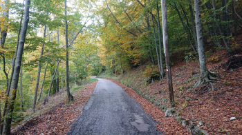
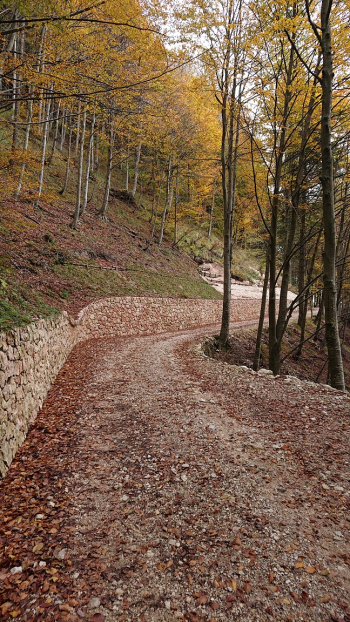
It starts at the cemetery in S.Andrea and climbs about 1km on asphalt and then turns right into the Tanara valley. At first asphalt and then mostly dirt with a few bad ramps you arrive at S.Bortolo.
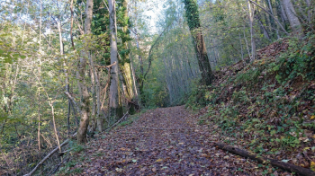
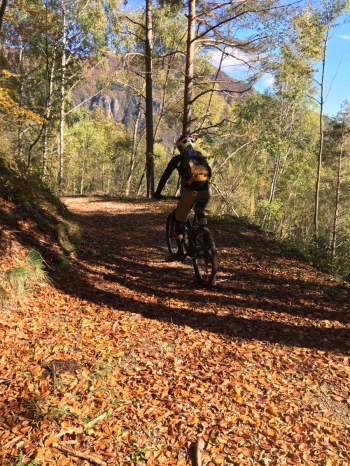
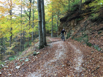
Keep right and on asphalt for about 1km you arrive at the entrance to the Orco trail. Between alternating up and down through dead leaves (most of it downhill anyway) you arrive at Campodalbero. Here there is a fountain where you can get water before setting off again.
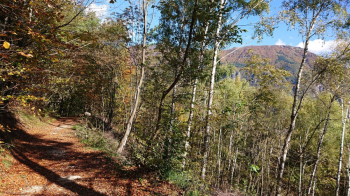
Uphill on asphalt for 6km (gradient between 5 and 10 percent down to -2 where in some places it reaches 12 percent) in an environment that is nonetheless evocative, you arrive at Località La Piatta (1250 meters) at Rifugio Bertagnoli, usually open all year round, where you can refresh yourself.
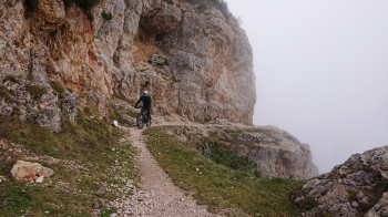
After the stop, we proceed uphill always with fairly regular slopes on a path towards Bocchetta Gabellele (1550 meters) and then taking a left towards the Milani path to get to Mesole Pass (1600 meters) and Scagina Pass (1580 meters). As mentioned above be careful because the trail is exposed but always well cyclable and rideable.
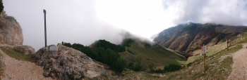
At Passo Scagina we descend to the left towards Malga Fraselle di sotto to face the last long descent of the day that takes us back to Giazza and then on a bike path to the starting point.
N.B.: for those who want to add some technical in the final part these alternatives can be considered:
- from Malga Fraselle di sotto instead of going down the forest road, take trail 281 (mainly uphill with some somewhat technical and exposed sections) + trail 282 downhill (quite flowing but with many tight hairpin bends that without nose press are difficult to do in the saddle) to get to rejoin the forest road. With this variation you add about 150 meters of elevation gain.
- From Passo Scagina go up again via Milani trails to Fraselle di Sopra (1630 meters) and Passo Zevola (1820 meters) where the trail becomes more technical and some sections will have to be pushed (max 10 minutes). Then descend on a rough trail with some technical sections to Passo delle 3 Croci (1710 meters). Here take Molesse trail 276. Quiet first part except for a couple of technical and exposed passages (so pay attention), then at Baito delle Molesse keep right always on 286 and start the second part where you enter the woods and surf until Lago Secco locality on dead leaves on path sometimes steep but always quite flowing and with hairpin bends all doable with decent technique but where the most experienced can safely dabble with the nose press. From Lago Secco you descend on asphalt to Giazza. With this variation you add about 400 meters of elevation gain.
- Other rather technical trails are 277 and 279.


