Giro del monte Rosa 1/5: Alagna/Rif. Pastore/Passo del Turlo/Bivacco Lanti
Very strenuous cyclo-mountaineering tour with lots of pushing and biking on the uphill (but also deportage on the downhill). The rest is pure wonder, crossing magnificent valleys with breathtaking views. Preface: we chose to ride it in enduro bike-packing mode on our own and without lifts, but considering the difficulty of the climbs, in hindsight, to save weight and enjoy the descents more you can easily lean on shelters along the way. Loop covered in the period from 18/08/2023 to 22/08/2023.
Day 1: ALAGNA/RIFUGIO PASTORE/PASSO DEL TURLO/BIVACCO LANTI (approx. 16 km x 1700 m d+)
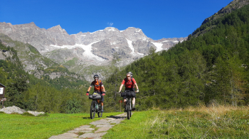
Start from the free park in Alagna at 8 am near the Carabinieri. Walk down the downtown street and arrive at a small square where there is a fountain. Breakfast and off we go. arrived at the little Pro-loco park we continue and see a bridge on the right, cross it to take a path that passes through the hamlet of Pedemonte. At the Wold park we cross again to take the paved road that leads up to the White Water Falls. Up to here we pedal easily, then it becomes trail/muletrack and still we can pedal almost all the way up to a fork. We descend to Rifugio Pastore for a short stop and some photos with Monte Rosa (you can see Capanna Margherita even with the naked eye).
We retrace our steps and take trail 207a (7a) that leads up to Passo del Turlo (2738 m) most of the mule track pushing, but higher up you can pedal something where there are some alpine pastures. Last steepest and bumpiest part requires carrying the bike. From the pass the view towards Valsesia and Val Quarazza is magnificent. The military road in the upper Val Quarazza slope is still very well maintained and is a work of true artistry.
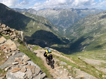
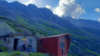
The descent begins and about 600 meters of elevation gain is lost to reach the bivouac. Almost all in the saddle except for a few small pieces that require attention. We arrive at the bivouac at 3 p.m., relax eating blueberries and think about the next stage. The bivouac has 9 -10 beds, there is a gas stove in the next room and there is a fountain with water.
Day 1 | Day 2 | Day 3 | Day 4 | Day 5


 Italiano
 Deutsch
