Italiano
 Deutsch
Paularo: Rifugio Fabiani - Casera Lodin Alta - Sentiero Las Callas

Route with ascent on asphalt to Casera Ramaz, left on steep dirt road to Rif. Fabiani, last stretch on trail to the refuge, ascent on steep trail and dirt road to Casera Lodin Alta, descent on medium technical trail to Ramaz, ascent on asphalt and descent on increasingly smooth Las Callas trail to Paularo.
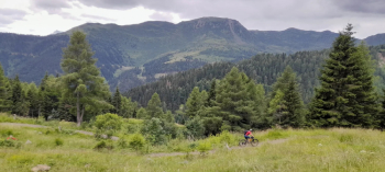
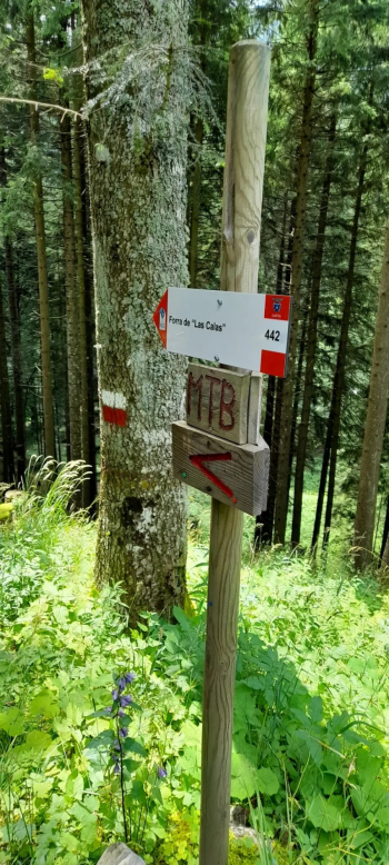
Start from Paularo and climb to the right of the stream towards Cason di Lanza on medium gradient asphalt, downhill section after the crossroads to Zermula and, having reached Casera Ramaz, take the immediately steep dirt road to Rifugio Fabiani, almost all in the woods, at the crossroads turn left on trail towards the refuge, which is in a splendid basin of pastures with spectacular border peaks. Take the same trail again and turn uphill on a dimly visible track to the left that climbs in part by pushing up to the steep dirt road that continues to climb, this time very scenic over pastures. You will soon reach Casera Lodin from which you could either climb to the left by pushing on a grassy trail to Lodinut Pass, or descend after the casera on CAI457, at first super scenic and then in the woods with sections on dirt and stones, hairpin bends and of medium difficulty, getting smoother as you descend. You leave the woods at Casera Ramaz, from which you descend and ascend on asphalt to the road that goes up to Malga Zermula and descend on CAI442 path to the right on stones and earth in the woods in the direction of Rio Maior stream and Las Callas path, which after a more technical section up to the ford then goes up (pushing for a little) and down the Las Callas path recently restored and much smoother and wider longo the stream, very pleasant and rather fast to Paularo.