
 Italiano
 Deutsch
Valle delle Mine

A Livigno classic, perfect for acclimating to the 1700-meter altitude of Little Tibet. Duration: 2 hours with breaks. If you want to avoid some asphalt here is an alternative climb.
This tour starts from the Mottolino valley station, since there is both a nice free parking lot there and the cable car, with which the lazy ones can save 550 meters of elevation gain. The climb is unfortunately on a paved road, the one that leads to the Eire Pass. From here you turn right in the direction of the lifts, with some healthy ramps that will burn your little legs not yet accustomed to the altitude. Just below the Mottolino top station our trail starts, which is still in the bike park at first:
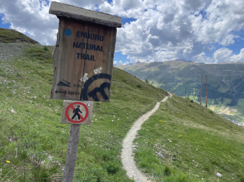
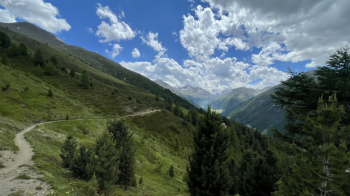
As of today, July 3, 2023, it has been put back in place; they've even got the boulders out of the way. After about 500 meters we leave the bike park behind and begin the traverse that takes us toward the Valle delle Mine, first with a very fast descent in which to pay attention to the new water channels, and then with several ups and downs. The view toward Bernina is spectacular; to our right, below, is Livigno.
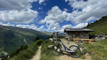
The steepest climb may require a short push, then we come to this little house with a cool fountain attached.
From here begins the descent that takes us into the Mine Valley. It is fast and invites you to let off the brakes, watch out though for a few curves that shoot outward and are a bit exposed. This leads to a dirt road that we follow uphill to a house. On the opposite side we already see the descent path, from aquilina in the mouth.
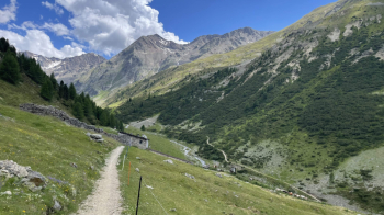
We cross the creek, steep ramp follows and then the descent begins. Beware of pedestrians, it is otherwise very flowy except for the final section that becomes steep and takes us back into the Livigno valley. Here we follow the path on the right side of the valley, with several ups and downs, and drop it at will to follow the bike path. If we follow it all the way to the end it takes us to Larix Park.
We thus arrive at the Mottolino parking lot. I recommend stopping just before the underpass at the Al Mond Vej bar/ice cream shop. The ice cream is great and not as crowded as the Livigno Dairy.
Tour also suitable for Ebikes.


