
 Italiano
 Deutsch
Testa Grigia
Itinerary for lovers of discomfort: the climb from Gressoney la Trinitè is totally on the shoulder, however, what an environment and what a descent! I chose to go up in the afternoon and sleep at the Lateltin bivouac to enjoy sunset and sunrise and to take it easy. I started from Trinitè because I was with the kids on foot but it would be preferable to ride from Saint Jean to avoid having to retrieve the car on the way back. It's about 250 meters of extra elevation gain.
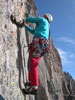
Start from Trinitè and if you park outside the village you can pedal to the 'beginning of the trail, in fact you can even do the first 30 meters of it. Then bike on your back and follow the signs for trail 10, which later becomes 10C. The gradient of the slope is always important, at one point you also have to do a section equipped with metal cable that with the bulk of the bike is not very easy, I recommend Hook-a-bike or similar.
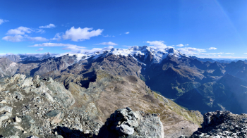
After a less steep section, where there are the remains of the basement of the former Cozzi bivouac, the trail ramps up again into an ocean of stones. Eventually you come out on the ridge between Pinter Peak and Testa Grigia: in 10 minutes you will reach the bivouac, if you do it in the day instead in about half an hour or so you will be at the top. You can take your bike all the way down to just below a passage with a chain, the summit is just above and the ledge and subsequent ferratina that leads to the summit are not cyclable unless you are a Martian. TOP views of the entire Monte Rosa group and Matterhorn.
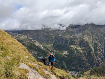
The descent starts with a technical section until you reach the col then easier up the entire large plateau below the bivouac. Once the little sloping section is over, the music changes dramatically: the next 300 meters of elevation gain are really tough and in some sections even dangerous because they are very exposed. Here the cyclability definitely drops depending on ability and above all the desire to risk one's skin. Some phenomena might even do it all or almost all. Toward the pass things get easier. You take to Gressoney and past the first little piece below the pass, quite technical but without danger, the trail becomes more relaxing until the first alpine pastures. Then it goes back to being the typical alpine trail, easier sections alternate with others that are slower and more driving, but always all doable with the right technique.
We pass the pastures of Montil and arrive at Alpenzù Grande. The last 350 meters of elevation gain will be quite a challenge. Always a very difficult and demanding trail, doing it all in the saddle will be quite a challenge. I candidly admit that the most difficult and exposed passages I did on foot. From the summit to Gressoney S. Jean is 1900 meters of pure adrenaline elevation gain mixed with fatigue.
P.s. to retrieve the car in Trinitè you can pedal since you 'll have done it little!
Here is the video of the climb:
..and here the one of the descent:
