
 Italiano
 Deutsch
2023/05/30 20:31:22
Agerola, Bosco delle Ferriere, Monte Megano
Author
Place
Italy - Campania, NA
Km
38,63 km
Elapsed time
07:09:47
Vertical meters
0 mt (89 - 1166)
Route difficulty
Landscapes
Last update
2023/05/30 22:41:50
Comments
Description
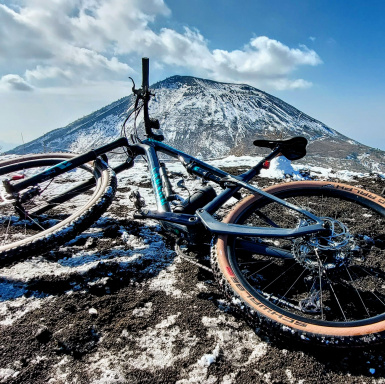
Loop itinerary, climbing on asphalt for about ten kilometers. Once you reach Agerola, you begin to climb with gradients of even more than 20% on compact terrain and cemented road. Once the dirt road begins, we finally reach the Ferriere woods that will take us to the top with a beautiful view of the Amalfi coast. The descent is very technical, first on dirt road full of gullies, then on stony ground.
Local weather
Today

36 °C
Tonight

24 °C
Tomorrow
34 °C
Tomorrow night
24 °C
Tuesday
34 °C
Tuesday night
24 °C
Graph
Nearest Routes
38,61 km
Km
+1 250 mt
Vertical meters
Route difficulty
Landscapes
32,50 km
Km
+782 mt
Vertical meters
Route difficulty
Landscapes
32,51 km
Km
+907 mt
Vertical meters
Route difficulty
Landscapes
25,94 km
Km
+443 mt
Vertical meters
Route difficulty
Landscapes
1,07 km
Km
-215 mt
Vertical meters
Route difficulty
Landscapes
1,02 km
Km
-162 mt
Vertical meters
Route difficulty
Landscapes
1,47 km
Km
-246 mt
Vertical meters
Route difficulty
Landscapes
1,40 km
Km
-212 mt
Vertical meters
Route difficulty
Landscapes
1,25 km
Km
-267 mt
Vertical meters
Route difficulty
Landscapes
1,97 km
Km
-375 mt
Vertical meters
Route difficulty
Landscapes